Sunday, June 14, 2009
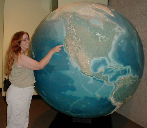
nice time-eating little map puzzle
Saturday, June 13, 2009
Friday, June 12, 2009
light over tokyo
static : pulse from Samuel Cockedey on Vimeo.
I'm not desperate to see Tokyo. Everything I know about Japan so far makes me okay with looking at lovely videos, and seeing it from a distance. Perhaps one spring or fall day, I'll ramble the countryside, though.
Exploring Southern California's inland habitats
He's got a picture of native fan palms here, which are vital to many bird and mammal species. For instance, the Hooded Oriole, which nests in its fronds, takes shelter there for the insulation; the air within the dead fronds that hang down can be ten to fifteen degrees Fahrenheit lower than surrounding air. In deserts that have several 100+ days every year, that's a big help. Though their traditional range is the desert of far southern California (and thus, so is the range of that oriole), they've been planted extensively as landscaping trees. When I lived in Fremont, in the San Francisco Bay Area, our neighbors had a fan palm too tall to trim dead fronds from, and Hooded Orioles, far to the north of their historic habitat, set up a nest, and frequently raided our hummingbird feeders.
If you've got fan palms and have the option to let the dead fronds stay, please do -- Habitat's a precious thing.
(Don't miss the rosy boa.)
Wednesday, June 10, 2009
That's great, it starts with an earthquake? again?
The BBC reports in one of today's headlines that there's a "Tiny chance of planet collision," and in its first paragraph, reports that this won't happen for at least a billion years.
New Scientist, on the other hand, which can be a bit overdramatic in its headlines, says "Solar system's planets could spin out of control" and in its first paragraph, qualifies that with "one day."
The graphics are fabulous, in either case. I get the sense that the smash simulations at the end of the video are more about "hey, check this out, BAM!" than they are about "here is a scientific illustration that will make everything more clear."
Tuesday, June 09, 2009
sometimes I miss the good old days
From Loving Fish, This Time With the Fish in Mind
I learned about buying sea creatures in the late ’70s at the sides of two old-time New Haven fishmongers who ran competing markets with differing styles. One brought in every fish he could find, mostly by going (or sending his help) to the Fulton Fish Market, Boston and Point Judith, R.I.
The other relied more on the trucks that worked the East Coast, going from fleet to fleet and market to market: A driver would start in Portland, Me., for example, with lobsters and scallops, and drive to Boston, where he might drop off lobsters and pick up cod and quahogs, then move on to Providence or Point Judith, where he would drop off whatever was in demand and load squid and swordfish. In New Haven he might find flounder. From there, he would hit New York, Cape May, Maryland, right down to Virginia or even Georgia or Florida. Then, his northern load diminished, his southern load — pompano, porgies, spots, snapper — in full supply, he would reverse the trip.
This makes me nostalgic. I may have missed out on the nickel-a-flounder days in New Haven, but I got to shop, learn about and cook fish at a time when my selections were varied and mostly local.
I find myself wanting to go along for the ride, to watch the season change with latitude, and watch the plants change, and the birds, and fish, and the accents of the working people on the east coast of the United States. (I live in California and grew up on the west coast. Accents?)
I know the "good old days" weren't always good at all -- DDT and women who felt trapped at home and kids with special needs who were marginalized and hawks shot for fun in New Jersey. And I love the internet, and air travel, and learning about and loving the whole world. But maybe we don't spend enough time moving slowly on the ground, and getting to know a small area well, and eating the food, and listening to people talk who work there, and live there, and feel the joy and the pain of the land and sea right through their shoes.
(I read the caption that accompanies this photo after I chose the photo for this post. Oh. See, these things also should be remembered.)
Monday, June 08, 2009
Thursday, June 04, 2009
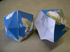
shapes of the world
And now I want to learn to fold this paper one.
beer geography quiz
(Aside from the odd foray into Belgian beers, which are their own special wonder, I almost always come back to Californian microbrews.)
Wednesday, June 03, 2009
Fee-free days coming up in the national parks
Just as California's state parks are on the verge of closing (and our governor is talking about "selling state property" including San Quentin, which makes me wonder a bit about other state land), the National Park Service is instituting a series of fee-free days in our national parks.
Now's the time to get out and visit.
When I was young, I thought Yosemite was overrated, by the way. Then I saw it, and can't imagine not having it.
For a listing of upcoming fee-free days, please check the NPS page about it.
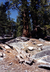
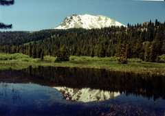
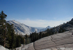
(Pictures below are of Lassen and Yosemite, two of my favorite parks.)


Tuesday, June 02, 2009
where?
Sequoia Sempervirens in Humboldt Redwoods State Park
FACT: For every dollar that funds the parks, $2.35 is returned to the state’s General Fund through economic activities in the communities surrounding the parks.
That means eliminating all funding for state parks could actually result in the state losing over $350 million dollars in revenue
I picked it up on Help4Wildlife, but that links back to (and credits) the California State Park Foundation for the information.
Sunday, May 31, 2009
I, for one, welcome our robotic rescuers
Saturday, May 30, 2009
Friday, May 29, 2009
California state parks system just got its throat cut
Schwarzenegger proposes cuts to schools, in-home health care, and state employee salaries, more
Desert (and other) state parks to close, more
On the other hand: California is also cutting home health care, school funding, funded mandates that allow animal shelters to keep animals alive for five days before killing them ... California is broke. Our treasury system is broken, we can't save money here. Bad times mean hard cuts, because we seem unable to prepare for them.
I love this state, and I wouldn't want the responsibility for running it -- but *argh* sometimes I want to pull my hair out at the decisions the voters and the legislators have made over the years that have gotten us where we are now.
Honestly, I don't know what to say. I don't want state park funding cut, or education cut. I don't know where we're spending money that we (in my rarely humble opinion) shouldn't be. I know California has been historically bad at saving money, both by habit and by constitutional restrictions. (And I know for sure our constitution and its processes are badly broken.)
We can't spend money we don't have, and regardless of why we don't have money now, we just don't have it.
What do we do?
Thursday, May 28, 2009
Girl Scouts are geographiles
Rachel (in 4th grade) was among the friends I went to the USGS open house with. She collected a bunch of material -- geologic maps, mineral posters, bookmarks, stamps, anything sciencey and interesting -- at the open house, and showed it to her Girl Scout friends, and they were fascinated.
Rachel is a science geek, and an interesting kid. Her Girl Scout friends rock.
There are a lot of good reasons for girls to participate in Scouting, if they can find a good troop:
- Girl Scouts don't require religious attachment or belief.
- Girl Scouts encourage girls to be bold and adventurous, to be smart, and independent.
- Girl Scouts have fun.
- Girl Scouts don't discriminate on the basis of gender identity or sexual orientation.
- Girl Scouts work on environmental awareness.
- Girl Scouts learn science.
What else rocks about Girl Scouting?
Wednesday, May 27, 2009
Thematic Maps
http://geography.about.com/od/understandmaps/a/thematicmaps.htm
Tuesday, May 26, 2009
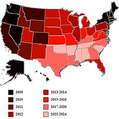
freedom map of the US?
The United States seems inexorably headed towards marriage rights for [same-sex] -- but how long will it take to get there across the board? Nate Silver has an answer. Based entirely on his hard work at fivethirtyeight.com, here is the future of [same-sex] marriage in the US:
The years indicated are those by which a [same-sex] marriage ban would be defeated by voters in a given state, according to a regression model designed by Silver....
How did Silver come up with these results? Here's the explanation:I looked at the 30 instances in which a state has attempted to pass a constitutional ban on gay marriage by voter initiative. The list includes Arizona twice, which voted on different versions of such an amendment in 2006 and 2008, and excludes Hawaii, which voted to permit the legislature to ban gay marriage but did not actually alter the state's constitution. I then built a regression model that looked at a series of political and demographic variables in each of these states and attempted to predict the percentage of the vote that the marriage ban would receive.
It turns out that you can build a very effective model by including just three variables:
1. The year in which the amendment was voted upon;
2. The percentage of adults in 2008 Gallup tracking surveys who said that religion was an important part of their daily lives;
3. The percentage of white evangelicals in the state.
Click through for more details.
Needless to say, I'd like to see this map go black as fast as it can go. I think any consenting adult should be able to marry any other consenting adult.
Monday, May 25, 2009
Redwood Canyon, East Bay Regional Parks
40%
FORTY PERCENT
It's so necessary.
Population control has to be part of it.
Clean energy has to be part of it.
Personal sacrifice must be part of it.
But 40% still seems like so very much.
How can we do it, really?
"Sign on" -- Okay. Now what?
Sunday, May 24, 2009
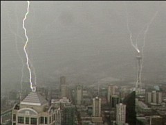
lightning hits the Space Needle
Here's the video:
http://geology.com/news/2009/lightning-hits-space-needle.shtml
And poke around geology.com for more nifty stuff.
A Green Journey for Conservation: Nathan Winters of follownathan.org
Nathan started in Maine and is now in his home state of Vermont. He's chugging along visiting farmer's markets and organic farms, talking to real people doing real work about sustainability and conservation.
(Nathan talks to Larry Bisbee about recycling.)
This is an expensive trip. He's saving travel expenses where he can, but this is a fundraiser -- your donations to the Nature Conservancy (one of my all-time favorite environmental organizations) are fuelling his spirit.
To learn more about Nathan's travels:
Also:
Nathan's flickr stream, awesome cafepress shop (I love that bike), youtube channel, facebook page, and twitter stream. (Nathan posts updates about his location to Twitter, including when he's looking for a cozy place to bed down for the night, so you can help by following his travels there, and letting friends know when he's approaching and could use their hospitality.)
Please visit http://follownathan.org/ to find out how to donate to the Nature Conservancy and support Nathan on his journey.
Saturday, May 23, 2009
a bit more of the earth from space

I never would have imagined -- at least, not right now, we'll see what a geography degree brings me -- chlorophyll, along with the other things they map.
The US Space Program isn't all about astronomy. It's invaluable to geographers, too, and I'm glad we don't ignore it.
Friday, May 22, 2009
Michael Palin to head up the RGS!
On June 1st, Michael Palin will be named as the new president of the Royal Geographical Society. The former Monty Python star has been travelling the world for more than three decades and says that his love of geography stems from school field-trips as a boy in Sheffield. He may therefore use his new position to promote geography in schools, previously arguing that the subject should be made “relevant, lively, stimulating, adventurous and…fun.
Oh SQUEE. Just SQUEE.
I love what I call "Palin's geography stuff." His *delight* with it -- his response to locals, his enthusiasm, his pure amateur joy at discovery -- is one of those things that helps feed my own, like John McPhee's, or David Attenborough's.
*SQUEE*
buuz!
The Hearty Food of Mongolian Winter.
Perhaps as much as with any National Geographic story, I felt like I had a sense of what hanging out in a Mongolian home is like.
Sharing water in the Klamath Basin
The Klamath Tribes and farmers have agreed to drop their state water rights battle pending approval of a federal agreement leading to removal of dams on the Klamath River.
The settlement filed Wednesday with the Oregon Department of Water Resources mirrors the water issues in the dam removal plan, known as the Klamath Basin Restoration Agreement.
(there's more at that link)
There's so little water in that area, and so much life depends on it -- salmon, migrating birds, farmers, ranchers, the water table.
The current cessation of hostilities is "pending approval of a federal agreement leading to removal of dams on the Klamath River." I'll certainly continue reading the book, and hope for the best.
Thursday, May 21, 2009
Monday, May 18, 2009
Earth from the Space Shuttle
I found them on boston.com's The Big Picture.
Some are NASA photos (and thus free to use with attribution) but some are copyrighted to Getty, AP, and at least one private individual.

I love the way the clouds in the streaky, mackerel-sky photo outline the west coast of Baja so beautifully, and the swirls in sea over . . . where is that? Africa?
Click through to The Big Picture to see more photos, including the non-NASA photos, and a great display of some of the tools the astronauts use -- and all the pictures are (of course) BIG.
This mission has driven me to nail biting and tears more than once. I love it. I am captivated. I envy the folks who get to do the EVAs, am sorry for those who aren't. I cheer Megan, who is from my area, and Drew, who is just the epitome of grace under pressure. And today, when John Grunsfeld knocked the cap off of an antenna, I carried my laptop around to do a few things I had to do around the house, because I couldn't leave the live feed, my heart was in my throat in sympathy with poor John. "I feel sick," he said. But they let him fix it, and he did, and everything's fine now.
Go John.
Go Atlantis and your crew, go Hubble.
Go human exploration of space.
Saturday, May 09, 2009
Random stack of books?
These are on my official Geography Table, thus the subject matter. But books like these comprise maybe 20% of my entire large book collection.

When I get my geopictures on the wall behind the table, I'll take books and blog about my geography table specifically, and why it's special. I just snapped this picture a minute ago and figured I'd share.
Friday, May 08, 2009
Jesusita fire from the air, with MODIS helping
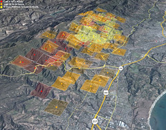
"A view of MODIS fire detections, looking east-northeast and across the fire perimeter from about 25,000 feet above Goleta. A new hot spot shows in the canyon above Patterson Ave, near some orchards (or vineyards) above San Jose Creek. Of more interest are the other new hot spots approaching Painted Cave, on the other side of 154 and near the ridge."
Click through to embiggen and comment for the mapper, of course.
I've lost count of the number of people calling it, "Jesus, it's a fire!" with the implied "Get in the car!"
Thursday, May 07, 2009
The Geography of the Jesusita Fire
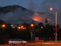
Ray Ford's article in the Santa Barbara Independent looks a little at the rugged residents and the rock-tough firefighters, but it also touches on the wind, the topology, the vegetation, and other things that drive a fierce wildfire in California's chapparal.
This is geography. It's not just about what burns, or why, but about how it all works together, and anyone
who really wants to study fires, damage prevention, and effective fire-fighting in California probably knows all of this:
"Then without warning, the wind shifted, catching everyone by surprise. The shift was sudden and intense. Within a minute it switched from a 10-to-15MPH steady uphill breeze to 50MPH storm force winds heading directly down canyon."
And that, yesterday, is why the apparently mild-mannered Jesusita Fire went crazy, and is still out-of-control along Santa Barbara's northern flanks. The mandatory evacuation order includes areas just north and west of Santa Barbara's downtown. Flickr has plenty of pictures so far.
Google Maps has some LA Times coverage including where homes have burned, and links to stories.
Monday, May 04, 2009
Going Meta
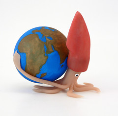
I'd appreciate knowing whether you read this blog, and if so, why, and what sorts of writing here most interest you. That will help me guide further posting. There might still occasionally be photos of baked clay squids with earths on their backs, though.
Saturday, May 02, 2009
Burakumin children fleeing an angry mob (and modern context, too)
The Burakumin were (are, in some minds) a very low caste of people who traditionally worked in fields that were related to death, such as grave-digging and tanning leather.
But that was centuries ago, right? According to modern leaders of communities of Burakumin descendants, having their historic neighborhoods visible in Google Earth is discrimination, or at least, facilitates it:
[Google] is now facing inquiries from the Justice Ministry and angry accusations of prejudice because its maps detailed the locations of former low-caste communities."
[...]
Castes have long since been abolished, and the old buraku villages have largely faded away or been swallowed by Japan's sprawling metropolises. Today, rights groups say the descendants of burakumin make up about 3 million of the country's 127 million people.
But they still face prejudice, based almost entirely on where they live or their ancestors lived. Moving is little help, because employers or parents of potential spouses can hire agencies to check for buraku ancestry through Japan's elaborate family records, which can span back over a hundred years.
An employee at a large, well-known Japanese company, who works in personnel and has direct knowledge of its hiring practices, said the company actively screens out burakumin job seekers.
"If we suspect that an applicant is a burakumin, we always do a background check to find out," she said....
Lists of "dirty" addresses circulate on Internet bulletin boards. Some surveys have shown that such neighborhoods have lower property values than surrounding areas, and residents have been the target of racial taunts and graffiti. But the modern locations of the old villages are largely unknown to the general public, and many burakumin prefer it that way.
Google Earth's maps pinpointed several such areas. One village in Tokyo was clearly labeled "eta," a now strongly derogatory word for burakumin that literally means "filthy mass." A single click showed the streets and buildings that are currently in the same area.
Google posted the maps as one of many "layers" available via its mapping software, each of which can be easily matched up with modern satellite imagery. The company provided no explanation or historical context, as is common practice in Japan. Its basic stance is that its actions are acceptable because they are legal, one that has angered burakumin leaders.
Much more detail is available at the link.
Google has, with the help of David Rumsey, removed information about these neighborhoods from the current updates for Google Earth.
It was Rumsey who worked with Google to post the maps in its software, and who was responsible for removing the
references to the buraku villages. He said he preferred to leave them untouched as historical documents, but decided to change them after the search company told him of the complaints from Tokyo.
"We tend to think of maps as factual, like a satellite picture, but maps are never neutral, they always have a certain point of view," he said.
Rumsey said he'd be willing to restore the maps to their original state in Google Earth. Matsuoka, the lawmaker, said he is open to a discussion of the issue.
I find myself wishing I'd re-installed Google Earth after I re-installed Windows a few weeks ago. I figured I would as soon as I wanted to use it, but now I want to look without updating, and see the older maps. Maybe a poke around David Rumsey's site would do the trick.
Still: I want to see it as a layer, in context, but perhaps, as the Japanese hope, with historical context given as well. Every modern nation has some history that needs a better light shined its way, Japan included.
women in science - geology
There are some photos in there with names and some description, but not enough information. The Smithsonian is requesting the help of flickr users in gathering more information about the scientists in the pictures.
Friday, May 01, 2009
map and globe vocabulary
I like reading maps and atlases written in different languages, both for the varying names of countries and features, as well as different words for basic map terminology.
irrigation system
(Also: I always say "rain, the crops are saved" because of the old shampoo commercial from the seventies that no one else remembers.)
Yay, Mediterranean climate. Yay, occasional interrupting shower, so I don't have to use the brand new irrigation system today.
Wednesday, April 29, 2009
Phoebe and Sophie are geographiles
I really love student videos. :D
Sunday, April 26, 2009
This almost makes me want an iPhone
I have no idea how well this app works, I've never tried it. I have no connection with the company that makes it. I just want to play with it.
Saturday, April 25, 2009
Yann Arthus-Bertrand makes art from the air

Click through to the link for a lot more of them.
Friday, April 24, 2009
satellite alphabet
Designer (creative director) Rhett Dashwood poked around on google maps for Victoria, Australia, and came up with an entire alphabet. I thumbnailed it for blogging, but am leaving you to go see the big version on his own website.
I need to take a little time and do one of these on my own. What fun.
The original page and much bigger image are right here at rhettdashwood.com.au.
Wednesday, April 22, 2009
Tuesday, April 21, 2009
Get outside! But come back and tell us what you saw.
Wildobs lets you upload the location of wildlife you find around North America (at least) with details about habitat, and mapped locations. I am going to explore the area near where I live, find out what's around at this time of year that I haven't yet noticed, and go look. It's a perfect "get outdoors now!" computer toy. (There's an associated iphone app, too. I don't see anything for my Treo yet.)
Monday, April 20, 2009
fussing about the weather
The thing is, only houses built since the mid-70s routinely have insulation, and far fewer than that have air-conditioning. Our house has no insulation at all, and despite having a patio on the south side and small windows on the west side, we can spend much of a warm day 5ive to ten degrees hotter indoors than outdoors. We start the day, on days like this, with fans at about 6 am. When the air blowing in goes from neutral to warm, we shut off fans, close windows, close up the master bedroom with the tiny in-room a/c unit, and hang out together in the one room. On a 95 degree day, that bedroom can be kept at about 80, while the hallway will be 86 or so, and the rest of the house at 90-100.
The blessing is that it's not humid. One of my most miserable days was in June 2006, in Boston, when it was 100F outside, 90% humidity. And just as a warning: There's nothing worse than smelling the tar decks of the USS Constitution on a day like that, then going to a kosher deli/restaurant and watching a waiter carry a pile of wiggly gravy-covered meat loaf past your table.
But I digress.
Here, it's about 93F right now, but humidity is in the mid-20s. It's starting to feel cooler outside than inside so I've reopened the house and turned the fans back on. I'm lying around, typing and sweating, with an ice pack between me and the laptop. It's not so bad.
We look moderate on paper partially because though we have days like today, the forecast for Friday is in the high 50s with a chance of rain, and just this time last week, I took this little video 20 miles from here, on a chilly afternoon.
(Photo was taken in San Francisco yesterday. It's possible the sensor was in the sun.)
Sunday, April 19, 2009
California's new Geospatial Information Officer explains what the GIO office is for.
On April 14, Michael Byrne, the new GIO for the State of California, explained the duties of the GIO office, and his position.
It seems like the right move, now, with so much of what happens in California facilitated by mapping and aerial photography, to integrate agencies and services with shared GIS directions and resources.
In which I share a little of my life
I love google. I love knowing where to find information. And I can't not know some things. This then comes back to my obsession
I had this instant-message conversation, just this morning:
(11:09:33 AM) Me: Casey asked me if the strait of gilbraltar were closing or opening -- I didn't know for sure.
(11:09:42 AM) Kimberly: : heh, no clue
(11:10:01 AM) Me: So now: Would you like to know about the geology of northern africa and the african/eurasian plate boundary? I had to find out.
(11:11:02 AM) Kimberly: : of course I would like to know!
(11:20:10 AM) Me: *grin* The African plate is moving north pretty fast, but most of the compression is happening in (causing, in fact) the Atlas Mountains, not closing the straits.
(11:20:49 AM) Me: The straits gradually opened from about 25 million years ago to 5 myo, but have been slowly, slowly closing since, with most of the compression happening elsewhere in the mediterranean, local N. African mountains, and 45% of it in the Atlas Mountains.
(11:21:43 AM) Me: I said to Casey, "You knew I couldn't not know, once I realized I didn't know." Casey said, "I know. It means I don't have to do my own research."
(11:21:52 AM) Kimberly: : lol
I'm sure some of the information is vague and/or inaccurate, and I certainly provide no citations. It was based on 15 minutes of reading from links I found via google. But still: This is how my life often goes.
Wednesday, April 08, 2009
Witnessing for ... Geohovah?
I used to know someone who kept a stack of books -- KJV (which he'd read through, and studied), probably the Jerusalem Bible, books on Paganism, the Book of Mormon, Buddhist texts, all sorts of things -- in a stack on the table next to the front door. He was an obsessive reader of psychology and theology, and every time something caught his eye at a book sale, he'd bring it home, and devour it. When folks wanted to come in and talk religion, he could do that, and did, and would sit them down for an hour or more to discuss things they weren't always ready to discuss. He'd pick up his books and leaf through until he found a relevant passage, read it, and bring it into the conversation. The proselytizers never managed to convert him from basic agnosticism, but it passed the time for him, and he liked meeting new people.
If this Geohovah's Witness guy showed up at my door, I'd take him to my special geography table and show him my atlases, geography texts, books about water policy and fire control in chaparral and bird identification and food politics in developing nations and plate tectonics and biodiversity, and of course, offer him coffee and cookies and we'd chat.
I must sound like him sometimes. I can't drive down Mission Bl. through Hayward, in California, without pointing out the Hayward Fault scarp. I can't be along the marine terraces of Highway 1 without explaining how they were formed. I especially can't see serpentine soil (or serpentinite) without getting into a discussion about its formation and ecology.
Water towers in Alameda County -- the kinds that used to sit in back yards, and hold water pumped up from the ground with windmills, for the households -- fascinate me endlessly. Can I control my urge to tell people about them, if they don't already know? No, not really.
I am a geography evangelist. I think I must annoy my friends sometimes. They say they don't mind, but I wonder.
(This sounds like I don't get the point of the video. I do, it just got me musing.)
Tuesday, April 07, 2009
zappos - the map
This isn't meant to be a Zappos ad, I like the company but don't have any vested interest in them at all, and am not any sort of shoe-diva. I am just in love with that map, the concept, the execution, the sheer for-the-sake-of-it goodness.
Friday, April 03, 2009
highly perfect basal cleavage
Wednesday, April 01, 2009
Basic map stuff - How colors are used
Years ago, in physical geography, we had to color in a physiographic map of the United States. I loved that activity, with colored pencils, and thin pens, and geology references. The teacher told us that we could choose our own colors, and one student showed him her map with the sea colored orange. He said, "I know I told you that you can choose your own colors . . . but just no. No. The sea cannot be orange." And he had her start over. It was sad, but . . . just no.
Sunday, March 29, 2009
lightning at Redoubt Volcano
Instead, I'll just give you this, a whole set of Redoubt photos, most showing the eruption, and a few, like this, with dramatic lightning.
I wouldn't mind watching this, with protection from the ash, and some distance.
Wow.
I did not take this photo, it comes from the Alaska Volcano Observatory.
Wednesday, March 25, 2009
Me and California
This is a big, flat map without most labels, and I had to wander around it and talk about it, and tell my companion about the White Mountains and the Bristlecone Pines, and (here) the various drainages of the Feather River, and about the Sutter Buttes and how they're a tiny mountain range, and we had to find the original Brokeoff Mountain remnants around Mount Lassen, and I could have stayed and looked at it for another thirty minutes or so.
I want this for my house. Is that too much to ask?
It's near the climate change exhibit at the California Academy of Sciences in Golden Gate Park. Go check it out. Say hi for me.
"Daylight Savings brings back Rose, the two o'clock titty."
(quickie, sorry -- off to do naturey things, more substantive post tonight)
(and yes, shadows cast on the earth by the sun are pure geography)

