Showing posts with label maps. Show all posts

Friday, January 21, 2011

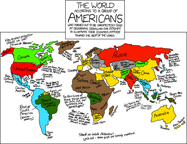
Breaking stereotypes but just a little


http://xkcd.com/

Note that when you go to the original page, and do the traditional xkcd mouseover for minor punchline in the alt text, you get the tidbit that Uzbekistan is one of only two doubly landlocked countries. Before I look it up, I have to figure out what the other one is.

Now I want to get a blank map, with only coast lines, not borders, and fill it in like this. I can put about 2/3 of Africa and nearly all of South America. Eastern Europe and what my husband calls "Soviet Blockistan," or the parts of Asia and Europe that were formerly Soviet Union countries, are a lot harder.

Sunday, May 02, 2010

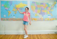
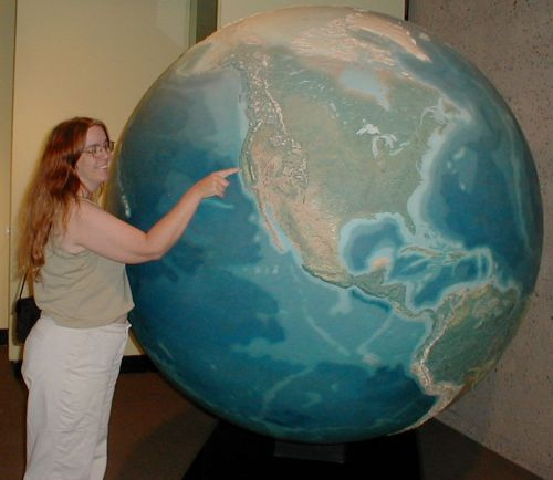
Geography Girl


Geography Girl
Originally uploaded by brentdanley.
I love that this geography picture keeps getting new notes appended. It reminds me of my urge to decorate a family room in maps, with globes and orreries and and old navigation tools everywhere.

Now all I need is my own family room, with a house to put it in.

(Click through to the photo on flickr to add your location to her maps.)

Monday, August 31, 2009

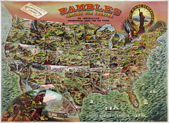
Rambles through our country

Oh, I want to play! The chances of my finding a copy of this game are slim, I know .... but still. What a find.The Library of Congress has the image. I want the *game*.

(The caption says:
From the Popular Graphic Arts Collection at the U.S. Library of Congress....This picture is in the public domain.)


edited to add at 10:26 pm:
Linda says that you can find the maps on ebay, and that the rules are on google books! Yay!

Sunday, August 09, 2009

traditional map skills

With so much emphasis in modern geography training on GIS, aerial interpretation, and other important skills, some basic traditional map skills such as orienteering have gone by the wayside.

Here are some traditional uses for maps that you might have forgotten about.

Wednesday, June 24, 2009

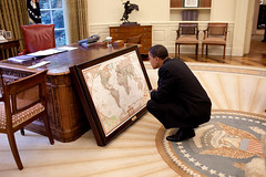
I wonder what details he's staring at

This is how I grew up, on my belly over the National Geographic Atlas, or the Times Atlas, noting changes in the various borders of Africa and Europe, or stopping in front of wall-mounted maps to stare.

I still do it. Nothing's changed, in more than four decades now. Maps make me stop and inspect the details.

Monday, June 15, 2009

longitude and latitude -- basic school video

very very very basic explanation of longitude and latitude:

Sunday, June 14, 2009

nice time-eating little map puzzle

US Map Puzzle -- Drag the states into their proper places using the Great Lakes as a placement guide.

Saturday, May 02, 2009

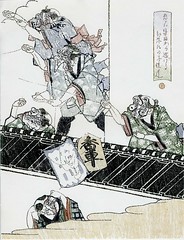
Burakumin children fleeing an angry mob (and modern context, too)

According to an AP story, Google included some old David Rumsey-archived maps of Tokyo in Google Earth's recent historical maps layer, including those that showed historic Burakumin.

The Burakumin were (are, in some minds) a very low caste of people who traditionally worked in fields that were related to death, such as grave-digging and tanning leather.

But that was centuries ago, right? According to modern leaders of communities of Burakumin descendants, having their historic neighborhoods visible in Google Earth is discrimination, or at least, facilitates it:

[Google] is now facing inquiries from the Justice Ministry and angry accusations of prejudice because its maps detailed the locations of former low-caste communities."
[...]
Castes have long since been abolished, and the old buraku villages have largely faded away or been swallowed by Japan's sprawling metropolises. Today, rights groups say the descendants of burakumin make up about 3 million of the country's 127 million people.

But they still face prejudice, based almost entirely on where they live or their ancestors lived. Moving is little help, because employers or parents of potential spouses can hire agencies to check for buraku ancestry through Japan's elaborate family records, which can span back over a hundred years.

An employee at a large, well-known Japanese company, who works in personnel and has direct knowledge of its hiring practices, said the company actively screens out burakumin job seekers.

"If we suspect that an applicant is a burakumin, we always do a background check to find out," she said....

Lists of "dirty" addresses circulate on Internet bulletin boards. Some surveys have shown that such neighborhoods have lower property values than surrounding areas, and residents have been the target of racial taunts and graffiti. But the modern locations of the old villages are largely unknown to the general public, and many burakumin prefer it that way.

Google Earth's maps pinpointed several such areas. One village in Tokyo was clearly labeled "eta," a now strongly derogatory word for burakumin that literally means "filthy mass." A single click showed the streets and buildings that are currently in the same area.

Google posted the maps as one of many "layers" available via its mapping software, each of which can be easily matched up with modern satellite imagery. The company provided no explanation or historical context, as is common practice in Japan. Its basic stance is that its actions are acceptable because they are legal, one that has angered burakumin leaders.


Much more detail is available at the link.

Google has, with the help of David Rumsey, removed information about these neighborhoods from the current updates for Google Earth.

It was Rumsey who worked with Google to post the maps in its software, and who was responsible for removing the
references to the buraku villages. He said he preferred to leave them untouched as historical documents, but decided to change them after the search company told him of the complaints from Tokyo.

"We tend to think of maps as factual, like a satellite picture, but maps are never neutral, they always have a certain point of view," he said.

Rumsey said he'd be willing to restore the maps to their original state in Google Earth. Matsuoka, the lawmaker, said he is open to a discussion of the issue.


I find myself wishing I'd re-installed Google Earth after I re-installed Windows a few weeks ago. I figured I would as soon as I wanted to use it, but now I want to look without updating, and see the older maps. Maybe a poke around David Rumsey's site would do the trick.

Still: I want to see it as a layer, in context, but perhaps, as the Japanese hope, with historical context given as well. Every modern nation has some history that needs a better light shined its way, Japan included.

Wednesday, April 01, 2009

Basic map stuff - How colors are used


Years ago, in physical geography, we had to color in a physiographic map of the United States. I loved that activity, with colored pencils, and thin pens, and geology references. The teacher told us that we could choose our own colors, and one student showed him her map with the sea colored orange. He said, "I know I told you that you can choose your own colors . . . but just no. No. The sea cannot be orange." And he had her start over. It was sad, but . . . just no.

Thursday, February 26, 2009

Philippine geography


Trying to come up with something important to say and all that occurs to me is "it's neat to hear the three languages work together like that."

Tuesday, February 24, 2009

Lilly the map kid

I've read so much about Lilly, and whether she's just parroting information, or really "knows" this stuff. What is knowing, when it comes to labels? Aren't we parroting, too? Does it matter, if she's learning to be fascinated by maps?

Friday, February 13, 2009

650 Million Years in 1 Minute and 20 Seconds

This is cool, and a bit dizzying, but I'm missing one thing: I thought the East African Rift would be pulling that continent apart along the rift zone. That's not illustrated here. What am I not understanding?


650 Million Years in 1 Min. and 20 Sec.

(Found on Matt's Geography Blog.)

Friday, May 04, 2007

Ian's bedroom


Ian's bedroom
Originally uploaded by kbreenbo.
When I was little -- and I was little, very small for my age -- I would lie on my belly on the floor and read our huge National Geographic atlas. I have a more recent edition now, and it seems big, but not gigantic. When I was small, the atlas was gigantic. It was out of date, but I read it cover to cover. (Later, in the map geography component of ninth-grade social studies, I was puzzled at some of the changes. It hadn't occurred to me before that the map I learned when I was on my belly reading the atlas at age 4 wasn't static, aside from the big changes of the world wars that my mother pointed out.) I loved reading the legends and finding out where paper was made, and sheep were raised. I loved trying to figure out city populations from the sizes of the dots. We had a globe with a relief surface, I would run my fingers over the mountains with my eyes closed.

As an adult, I still love maps and atlases and globes, and as an educator, I have loved introducing them to children. I like to leave Me on the Map around a classroom, along with basic atlases (chosen according to the age of the child with durability in mind, if nothing else). For kids of kindergarten age, I like to draw small maps with them, of the playground, or the classroom, or even items on a table. From there, the street can be mapped, or the block, or a neighborhood, labeled with places important to the children.

It's not important exactly how they're introduced, except that materials are left around with ready access (inflatable globes are cheap and fun), and that the children's interests lead the way.

When I saw this picture, "Ian's Bedroom," I immediately wanted to be four, and to have wallpaper like this in my own room. I wouldn't paper a classroom like this (too busy, especially if the kids' own artwork is displayed), but I'd certainly paper a rec room or a bedroom or a cafeteria with this wonderful giant map.