Wednesday, January 04, 2012
San Francisco is a great place to visit, but I wouldn't want to live there.
Stephen Fry likes it, in part because it's near so many beautiful places:
That's one of my favorite things about Northern California in general: It's a short drive to the High Sierra, some of the most beautiful parts of California's coast, to farmlands, to really great urban advantages, to the Golden Gate Bridge, to science museums and art, because there is open space and nature everywhere -- visionaries began preserving it here more than a century ago -- and because we have the climate to enjoy it year-round. (That is true for most places depending on what climate you like; with my tendency to get really sick in hot humidity, I can't bear those climates in the summer.)
I don't want to live in San Francisco though. I have before, but now, I want a yard for my dog, and I want not to have my house actually touching other houses (it's just a fire danger worry, house fires there can displace a few families), and San Francisco proper gets a bit cold and windy for me off and on all year, what with water on three sides. And I'm a gimp, and SF has a lot of uphill and downhill.
But it's a nice place to visit, and I'm glad I get to do that a lot. I discover new things there on a regular basis, though I've been visiting for nearly 50 years, and I'm glad I get to raise my child so near such a treasure.
Tuesday, November 02, 2010
Do you know what's ridiculous about this map?
Driving directions to Honolulu, HI
14 days 22 hours
I-5 N
3,748 mi
California
1. Head west on Terrace Ave toward Tivy Valley Rd 266 ft
2. Terrace Ave turns slightly left and becomes Tivy Valley Rd 0.5 mi
3. Turn right at N Piedra Rd 3.8 mi
4. Turn right at CA-180 W/E Kings Canyon Rd Continue to follow CA-180 W 19.7 mi
5. Take exit 57A to merge onto CA-99 N toward Sacramento 132 mi
6. Continue onto CA-12 E 1.0 mi
7. Continue onto CA-99 N 31.7 mi
8. Take the exit toward San Francisco/I-80 W/I-5 W/CA-99 W 1.2 mi
9. Merge onto CA-99 N/Interstate 305 W 1.3 mi
10. Take the exit onto I-5 N toward Redding
Passing through Oregon
Entering Washington 757 mi
11. Take exit 169 for NE 45th St 0.3 mi
12. Slight left at 7th Ave NE 262 ft
13. Take the 1st left onto NE 45th St 0.7 mi
14. Turn left at Wallingford Ave N 0.9 mi
15. Turn right at N 34th St 292 ft
16. Take the 1st left onto Densmore Ave N 436 ft
17. Turn right at N Northlake Way 285 ft
18. Kayak across the Pacific Ocean
Entering Hawaii
2,756 mi
19. Continue straight 0.1 mi
20. Turn left at Kuilima Dr 0.5 mi
21. Take the 3rd right onto HI-83 W 12.4 mi
22. Continue straight onto HI-99 S/Kamehameha Hwy 6.5 mi
23. Slight left at HI-80 S/Kamehameha Hwy
Continue to follow Kamehameha Hwy2.1 mi
24. Take the ramp onto I-H-2 S 8.1 mi
25. Merge onto I-H-1 E 4.7 mi
26. Take exit 13B toward Halawa Hts. Stadium 0.3 mi
27. Merge onto I-H-201 E 4.1 mi
28. Merge onto I-H-1 E 2.3 mi
29. Take exit 21A for Hawai 61 toward Pali Hwy 0.2 mi
30. Keep right at the fork, follow signs for HI-61 S/Downtown and merge onto HI-61 S/Pali Hwy
Continue to follow Pali Hwy 0.4 mi
31. Continue onto Bishop St 0.2 mi
32. Turn left at S King St 0.3 mi
33. Turn left at Likelike St 446 ft
Honolulu, HI
It's just silly. Why would you waste time and gas driving to Puget Sound only to have to kayak that much farther to Honolulu? Kayaks are available for rental all along Monterey Bay, which is nice and central within California, as well as north and south along the entire coast.
Sheesh.
Friday, July 16, 2010
the sky is falling
Geologists discuss the rock falls, and their effect on park visitors, and there's some great video from a park visitor.
The video's a granite-lover's dream, with obligatory spectacular views of Yosemite as well.
I'm feeling less inclined to scramble in the talus looking for pikas than I might once have been.
Does the information in this video affect how you would use Yosemite, or whether you would visit the park or similar areas?
Sunday, April 11, 2010
Fascinating Northridge quake coverage
(Have I posted this before, years ago? I should look. But it's a cold, rainy morning, and the dog is asleep on me, and that sounds like a lot of work for today.)
Friday, April 02, 2010
frazil ice in Yosemite National Park
I'd never heard of frazil ice before. Now, because I must look things up compulsively, I'm learning about it. Wikipedia says, "Frazil ice is a collection of loose, randomly oriented needle-shaped ice crystals in water. It resembles slush...," which probably explains why I'm imagining margaritas. And Hajo Eicken at the Geophysical Institute at the University of Alaska, Fairbanks, says
The word frazil means fine spicules or blobs, which gracefully describes the morphology of the crystal. Sea ice growth always begins with frazil ice production, the only true dendritic ice growth phase. Active convection aids sensible heat transport at the ocean surface, thereby super cooling the water and allowing dendritic growth of ice crystals.This is so cool. Spicules and blobs. Scientific terminology rocks. ("Dendritic," of course, means it's like branches of a tree, like drainage in a river delta, or the shape of a neuron.)
The waterfalls of Yosemite must be delightful just now.
Monday, March 08, 2010
... but not as we know it
Wow.
I love the Mono Lake basin because it's stunning and fascinating.
The Sierra Nevada rise along its western side.
Panum Crater, to the south, is a small volcanic cone a few hundred years old. When you hike up into it, first you walk over crunchy pumice, then over pieces of obsidian that tinkle underfoot like broken glass, making the thought of a stumble slightly nerve-wracking.
I once saw a Long-tailed Jaeger in a freshwater pond just north of Mono Lake. It's a pelagic bird that was lost ... or interested. Many species of bird feed on the brine flies at the edge of the lake. Eighty-five percent of California Gulls (the species, not the geographically-placed) breed here.
And Mono Lake plays an important role in the history of the environmental movement, its healthy future being the impetus for the Mono Lake Committee, one of the most effective and inclusive grassroots environmental movements in California.
But now, the possibility of parallel evolution? arsenic-based life? Mono Lake just gets cooler.
Sunday, February 28, 2010
At least the birds got a few extra mud-critters for lunch
As much as that this video is nearly ten minutes long, I wish it had been longer. I'm not sure I'd want it edited, either -- I like the everydayness of it, the way people are talking to each other, and their wonder at the water.
I'm working on a bigger post about Chile, which I'll post in 12 hours or so.
Sunday, January 31, 2010
Sunday, January 24, 2010
ferocious weather
Our tornados in California are almost never as high as 2 on the Fujita scale, and are usually 0 or 1. This one touched down, but well away from where it could do damage.
I keep thinking, "Now I'm going to write about this wacky week of weather," but then we keep having more days of it, and I think, "As soon as it's done ..." Rain is in the forecast, but it looks like the wildness is calming down. Perhaps it's time.
Wednesday, January 06, 2010
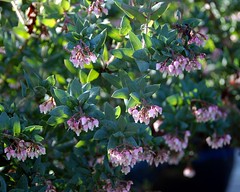
Arctostaphylos pajaroensis 'Warren Roberts' - Warren Roberts Pajaro Manzanita
Originally uploaded by pete@eastbaywilds.com.
Monday, October 12, 2009
Feed the child
I learned to swim in creeks and lakes. I peeled endless acorns in my attempts to make acorn mush under trees while friends had tea parties in their bedrooms. I used my magnifying glass to set small piles of oak leaves on fire in my driveway, knowing better than to try that out in the woods.
When I was little, we were allowed to run around the woods (some of it has become a giant church complex, some is now protected as park) and nearby fields. I think I was 7 or 8, just old enough for my mother to append “bring your sister” to my requests to go play “in the fields,” as we called them. My sister wasn’t yet in kindergarten, and hauling her along was like dragging an anvil behind me as I ran off to the trails and creekside on the road to adventure.
Mom taught us how to avoid rattlesnakes and poison oak (we didn’t assume there were mountain lions around, but there had to be, we were right on the edge of town), and told us to be home before dusk, then sent us out to play. There was really nothing we were forbidden except to go into the rain culvert where Churn Creek went under Highway 44, in case of flash flood – so we did, of course, and would stand under the stormwater grates and listen to the roar of cars and trucks overhead, reveling in the danger. I didn’t climb trees, but the live oaks and black oaks often had multiple lanes of commuting black ants, and the gray pines were sticky with sap, and weren’t good climbing trees.
Instead, we collected sticks and branches and crunchy, prickly fallen leaves and wove forts not much bigger than our bodies. After intense summer thunderstorms, we’d go out to where the boys on their bikes had worn ruts over the dead grass and hard dirt near the creek, and slide down the mud-slick ramps on our bottoms. We had church clothing, school clothing, play clothing, and “mud clothing,” the bottom of the barrel, as Shasta County’s iron-rich soils leave permanent red tint on any clothing that touches it when it’s wet.
We picked wildflowers in the spring, and on the first of May, we made paper baskets, then filled them with brodaeia and shooting stars and lupine and wilting poppies and hung them on neighbors’ doorknobs, ringing the bell, then running away. We knew the names of most of the flowers – Mom called everything by name -- but she called all the brodaeia species “blue dick,” and called all the hummingbirds “ruby-throated” because in our basic birding guide, that was the only hummingbird with a red throat. (Anna’s weren’t in the book, and weren’t part of Mom’s Modoc County childhood, as they’ve only gradually moved north with human population.) Turkey vultures were “buzzards.” Everything had a name, though they weren’t always accurate names. We called gray pines “digger pines,” as that was their name then. We knew they were named after the foothill native people who were called “Digger Indians,” but even though my grandmother was an advocate for and sympathetic friend of the Pit River and Maidu people, it never occurred to any of us that “digger” was a racist euphemism.
One of my iconic memories that defines what gave root to my adult curiosity came on a late spring day, on one of the several trips to Burney Falls and Mount Lassen that we took every year. Redding was much smaller, then, and roads in the surrounding hills were often quiet. We were somewhere up near Kings Creek or Hat Creek, and there were turkey vultures rising on the morning thermals. They seemed to be doing their morning cruise more than looking for food, so Mom pulled over. “Get out of the car,” she told one of my older sisters. “Lie down in the middle of the road.”
Terry’s mouth fell open, and she shrieked, “WHAT?”
“Just lie down.”
“I’ll get run over!”
“I’m watching, I’ll tell you whether a car is coming.”
These days, ornithologists know that turkey vultures hunt by smell, not sight, but in the sixties, most people hadn’t learned that. My sister lay in the middle of the road for awhile – a minute, or five minutes, I was young – then leaped up to brush her clothes off and yell at Mom for risking her vulnerable child’s life.
The vulture hadn’t landed, no traffic had come by.
Had a vulture landed, would Mom have allowed it to pick out Terry’s eyes? Would she have scared it off? I might never know. Mom was that kind of woman.
This is the story that I most vividly remember, about Mom’s fascination with nature, and how she fed it to her children, but it’s one of many. Her willingness to live in nature, not as a spectator, but as an active participant, flowed onto and into me along with her milk and her singing when she was happy, and later her taste for ginger and marzipan.
Tuesday, September 01, 2009
The Station Fire - this time with armageddon
After the Oakland Hills fire, officials sprayed the steepest hillsides with goo to glue the dirt together, mixed with wildflowers seeds - and the next few springs were stupendous. I'm not sure there's enough glue in the world for the San Gabriels, one of the fastest-rising and most fragile mountain ranges in the world -- but I hope they try something like that.
Thanks to Ian O'Neill for the pointer.
Who ya gonna call?
We definitely get lightning, and parts of the state get intense lightning.
When I was little, in Shasta County, the grid wasn't as robust as it is now. We'd get days where the temperature would be 100, then 105, then 110, and sticky humid, unlike what we're used to in parts of California that aren't the northwestern corner. Then kaboom, the angels would start bowling, as Mom described it, and we'd have a huge storm, and the rain would pour. The power would go out, and we'd eat hot dogs cooked on unbent metal hangars in the fireplace, and pop popcorn in my mom's old campfire popping basket, and toast marshmallows, and sing. We were a girlscouty sort of family like that. Then we'd go to bed, and at some point the next morning, the power would come back on, usually just in time to power our tiny air conditioning unit in the living room so that as the temperatures rose back up into the 90s, we could lie in front of it and read. If the gutters were still running, we'd go block off the storm drain with detritus and walk around in our boots or pretend to fish.
There are other parts of the state that get lightning storms. But for the most part, we don't get big thunderboomers in California, the storms slide on overhead and aren't terribly dramatic.
We worry a bit when they come over, sometimes, as our summers tend to be dry, and a dry lightning storm can be troublesome. But lightning doesn't terrify me the way it can people in, say, Florida, where death by lightning is generally understood as one of the ways to go.
Saturday, August 29, 2009
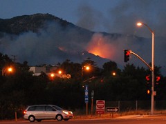
Station Fire - August 29/30
Time Lapse Test: Station Fire from Eric Spiegelman on Vimeo.
It's late and I'm sleepy, having paid too much attention to it today because a dear friend lives a couple of blocks outside of a mandatory evacuation zone. Things seem to be going reasonably well for her, in terms of how well the firefighters are protecting her little corner, but it's nerve-wracking.
The Briggs Terrace neighborhood is in worse shape -- okay for now, but transitions between night and day do weird things to weather and air circulation, and thus fire behavior.
Of course there are other fires burning in California. It's summer, after all.
That's the one capturing my attention right now.
Tuesday, June 02, 2009
Sequoia Sempervirens in Humboldt Redwoods State Park
FACT: For every dollar that funds the parks, $2.35 is returned to the state’s General Fund through economic activities in the communities surrounding the parks.
That means eliminating all funding for state parks could actually result in the state losing over $350 million dollars in revenue
I picked it up on Help4Wildlife, but that links back to (and credits) the California State Park Foundation for the information.
Friday, May 29, 2009
California state parks system just got its throat cut
Schwarzenegger proposes cuts to schools, in-home health care, and state employee salaries, more
Desert (and other) state parks to close, more
On the other hand: California is also cutting home health care, school funding, funded mandates that allow animal shelters to keep animals alive for five days before killing them ... California is broke. Our treasury system is broken, we can't save money here. Bad times mean hard cuts, because we seem unable to prepare for them.
I love this state, and I wouldn't want the responsibility for running it -- but *argh* sometimes I want to pull my hair out at the decisions the voters and the legislators have made over the years that have gotten us where we are now.
Honestly, I don't know what to say. I don't want state park funding cut, or education cut. I don't know where we're spending money that we (in my rarely humble opinion) shouldn't be. I know California has been historically bad at saving money, both by habit and by constitutional restrictions. (And I know for sure our constitution and its processes are badly broken.)
We can't spend money we don't have, and regardless of why we don't have money now, we just don't have it.
What do we do?
Friday, May 22, 2009
Sharing water in the Klamath Basin
The Klamath Tribes and farmers have agreed to drop their state water rights battle pending approval of a federal agreement leading to removal of dams on the Klamath River.
The settlement filed Wednesday with the Oregon Department of Water Resources mirrors the water issues in the dam removal plan, known as the Klamath Basin Restoration Agreement.
(there's more at that link)
There's so little water in that area, and so much life depends on it -- salmon, migrating birds, farmers, ranchers, the water table.
The current cessation of hostilities is "pending approval of a federal agreement leading to removal of dams on the Klamath River." I'll certainly continue reading the book, and hope for the best.
Thursday, May 07, 2009
The Geography of the Jesusita Fire
Ray Ford's article in the Santa Barbara Independent looks a little at the rugged residents and the rock-tough firefighters, but it also touches on the wind, the topology, the vegetation, and other things that drive a fierce wildfire in California's chapparal.
This is geography. It's not just about what burns, or why, but about how it all works together, and anyone
who really wants to study fires, damage prevention, and effective fire-fighting in California probably knows all of this:
"Then without warning, the wind shifted, catching everyone by surprise. The shift was sudden and intense. Within a minute it switched from a 10-to-15MPH steady uphill breeze to 50MPH storm force winds heading directly down canyon."
And that, yesterday, is why the apparently mild-mannered Jesusita Fire went crazy, and is still out-of-control along Santa Barbara's northern flanks. The mandatory evacuation order includes areas just north and west of Santa Barbara's downtown. Flickr has plenty of pictures so far.
Google Maps has some LA Times coverage including where homes have burned, and links to stories.
Sunday, April 19, 2009
California's new Geospatial Information Officer explains what the GIO office is for.
On April 14, Michael Byrne, the new GIO for the State of California, explained the duties of the GIO office, and his position.
It seems like the right move, now, with so much of what happens in California facilitated by mapping and aerial photography, to integrate agencies and services with shared GIS directions and resources.
Monday, February 23, 2009
The Cinematic Geography of the Los Angeles area
I don't think Fox Plaza really blew up. There are a lot of reasons I wouldn't choose to live in Los Angeles. The first time I ever drove there, I had to find a friend's house in Hollywood at 1 am, I'd been driving only a few months, and her directions failed because 101 through Hollywood was closed for a movie filming. I had to make my way through city streets, without a map, without google maps on my Treo, hoping for the best, not knowing where I could stop safely. Fortunately, my habit of reading maps for fun gave me a basic understanding of LA geography and where I was headed, and my sense of direction and knowledge of main streets took me right to her apartment -- only two hours late.