Tuesday, July 14, 2009

Hot town, summer in the city


manhattanhenge
Originally uploaded by photographsdikdik.
Twice a year, the sun rises and sets in alignment with the (not quite) east-west grid of Manhattan's streets. The sun shines down the length of the urban canyons, and everyone with a camera comes out to take pictures of the phenomenon that has come to be known as Manhattanhenge.


ocean's edge processes - I was transfixed

Typically, I don't much care for the slideshow variety of presenting this sort of information. But something about the way the titles worked in this, and the music -- I might always be a sucker for Mark Knopfler and Dire Straits -- pulled me in, and I watched it until the end.


That said, I'm not sure it helped my understanding of the ocean's edge. I had to poke around on the web afterwards to figure out what a tombolo is.

Monday, July 13, 2009

If there were a simple answer ....


Hut
Originally uploaded by jackol.
A few months ago, when folks were starting to fuss about climate change and overpopulation causing water wars, I read in quite a lot of places that areas that historically have little water tend to use it peacefully, and the world would adapt.

But this, in The Guardian:

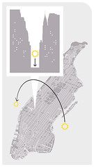
It was a little after 8pm when the water started flowing through the pipe running beneath the dirt streets of Bhopal's Sanjay Nagar slum. After days without a drop of water, the Malviya family were the first to reach the hole they had drilled in the pipe, filling what containers they had as quickly as they could. Within minutes, three of them were dead, hacked to death by angry neighbours who accused them of stealing water.


I think we can slow, but not stop climate change, and doing so won't be enough to prevent real suffering. Controlling population will help, but how? We have to almost stop. Otherwise, it will get much worse before it gets better.

So far, I'm not one of those people who believe that technology will help us cope with 10 billion people on the planet, or 15 billion people. Or rather, technology will help, but it certainly won't make it better, just perhaps not as horrible as it could become.

And deep down, I don't think it's ethical or good public policy to enforce family size or procreation. (Look at China: Too many boys, second children -- or first, if girls -- given to orphanages, and rural/poor people still having extra children. "One Child" is controlling the population, but at what cost? And how can we compare that usefully to what Asia would be like now otherwise?)

I get fussy about countries like Japan and Norway complaining about low birthrate and encouraging people to have more babies so there will be someone around whose taxes can care for an aging population. I got downright grotty at Australia's John Howard, who encouraged Australians to have more babies even as the country was running out of water. But then what do they do to keep the population balanced?

I'd say they should be encouraged to adopt from poorer parts of the world -- but that way has led, in the past, to tragic exploitation. I'd say they should encourage families with young children to immigrate from areas that are more bottom-heavy in the age demographic department but then who supports these families as their children are educated and enculturated in the new country, as they move toward long-term residency, citizenship, and tax-paying status? And how do you get past the historically xenophobic practices in some of these developed countries?

I don't feel like I can write about this logically, but I'd like to somehow.

If there were a simple answer, we'd be implementing it right now. No?

Friday, July 10, 2009

*splash*

I'm going to call this geography because the view of the earth from the falling rockets is amazing:


I wonder (and one of you must know): How small is the bit of ocean do the engineers know the rockets will fall into? How far away are the retrieval ships, for safety?

I love the splash at the end, and how the cameras keep working.

Thursday, July 09, 2009

One of my all time favorite David Attenborough moments

You might have already seen the fabulous lyrebird of Australia

Wednesday, July 08, 2009

sense of place - Burney Falls


Burney Falls
Originally uploaded by Buck Forester.
I didn't take this, but I want to share it.

Here's how I commented on the picture on Buck's photostream:
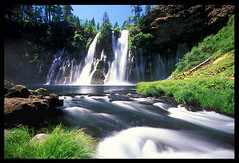
I have visited those falls more times than I know, as my mom grew up in Modoc County and I grew up in Redding, and Mom took us to Burney as often as we could go, pretty much.

Sometimes I google around from photos, just because Burney Falls is sort of my church, it's one of my favorite places in the world, and just looking at photos is sometimes enough to help me feel cool and peaceful.

And this is the best picture of my wonderful falls that I've ever, ever seen. Thank you so much.

Obama on Mount Rushmore


As I post, the Park Service is cutting down the banner. But for awhile this morning, Greenpeace managed to hang a banner on the face of Mount Rushmore (without disfiguring the monument at all) to make a visible statement about climate change.

Whatever you think about them or their methods, and whatever I do (hint: for the most part, I approve), I like that they didn't damage the monument at all, and that they were so live and visible about it at the time.

From Ustream:
greenpeacechat

(Note: That really is supposed to be Obama's face on the banner, and it was even visible as such now and then behind ustream's less-than-clear streaming quality at the time. There's only so much live datastreaming from a remote location can pull off.)

....and now an update: Treehugger has added video. Please go check out their post, too.

Tuesday, July 07, 2009

Lego world


Lego world
Originally uploaded by futureatlas.com.
From Future Atlas:

If you loved me, you'd totally make me one of these.

Monday, July 06, 2009

The Joy of Work

The BBC gives us the North American beaver going about its daily business:

Sunday, July 05, 2009

Friday, July 03, 2009

Unreinforced masonry in Portland, Oregon.


fish_through_wall_08659
Originally uploaded by original_MikZ.
Well, no, not really.

My only phobia besides heights is unreinforced masonry, because of the whole "falls on head in earthquake" issue. But I am quite sure this is reinforced.

Clearly, it was just a very strong fish.

oooh, waves! low pressure systems!

getting by in Bolivia ... the hard way


Coroico Bolivia
Originally uploaded by Chris-Ecuador.
We're not going into the heights thing this time.

Seriously.

But this got to me:

Juana Combata used to cross the valley almost every day with her family-- hanging on to the cable that links her community to the rest of the world. But one day in June of last year, things changed.

A piece of steel holding the plank holding Juana, her husband, and her 3-year-old son, broke, and they plummeted nearly 100 feet to the shore of the river, hitting the rocks below.

Her 3-year-old child died instantly.

Juana and her husband Edwin survived with some injuries.

"Nowadays I don't cross the cable that much, I'm afraid since I fell down. If I have to do it I go alone, I fell with my son, my husband... so now I just grab my baby and go alone with him."


The rest of the interview, with the (non-embeddable, dangit) video is at National Geographic.

They have to cross that cable to survive. They put their kids on it, balance carefully, and slide. I guess I'd do it if I had to, but I can't imagine doing it after a fall like that.

The area is rich in coca-based agriculture. The Combatas grow mandarins, and send them off to LaPaz on a journey that begins in a basket hanging from that river cable.

Now I wonder whether the Combatas are growing mandarins in a way that hurts the forest.

The World Wildlife Fund says:
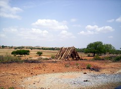
Although Bolivia has a decent and growing National Parks (NP) system, threats in the form of habitat loss and general degradation due to human activities persist outside protected regions. This ecoregion is threatened because it is easier for local agrarianists to burn this habitat than true montane forest for growing cash crops. In some cases crops and logging have increased due to more intensified road-building efforts. Extensive forest clearance in the Bolivian Andean foothills to cultivate crops has endangered over 70 species of birds, especially in the Departments of La Paz and Cochabamb. Additionally, certain game species from this ecoregion are threatened by over-harvest for protein and/or the wild bird trade.

(citations and more information at original link)

Of course, this sort of degradation is common worldwide, in both developing and well-developed nations.
In many cases, that's what "development" is.

But it's not sustainable.

The Combatas and their neighbors have to eat.

Helping them do so without ruining their local ecosystem is part of the overall, global sustainability picture.

Thursday, July 02, 2009

Saraychev Peak is awesome, as are fast-on-the-shutter astronauts

From Bad Astronomy (one of my favorite blogs)
comes a time-lapse series of Saraychev Peak erupting
and wow is this cool. You've seen the photo series, I suppose. This one is run back and forth, looped, run in slow motion, run in slow motion with the pyroclastic flows highlighted .... it's a two-and-a-half-minute video, but I stared at it all the
way through, then ran back over the most compelling bits, then ran it all way through again.

It's worth spending some time with. I just wish the series were longer, that we could watch the
ash bloom further out of the side of the cloud the eruption created as it pushed air into a colder layer.

I guess asking the ISS to stop for a few minutes so the astronauts could take more pictures would have been asking too much.


(Note: It's got some interesting music attached. I'm sure the video won't take offense if you watch it without sound on.)

Alpha Centauri can finally see Janet Jackson's nipple


electromagnetic_leak
Originally uploaded by marymactavish.
The Abstruse Goose comic illustrates where the electromagnetic waves we're flung into space are now.

Sadly, folks on the furthest planets haven't yet seen Gilligan's Island. (I assume this means that Thermians come from somewhere near Formalhaut.)

(The big version's back at Abstruse Goose. It'll take you out past Aldeberan.)


(edited to add: This post led to a huge discussion in my house about how long the Thermians would have been able to see our TV shows, how long it took to build the ship, and whether they might have sent probes nearer to us to collect data, then had them return via hyperspace, faster than light, meaning that they would have more information from our TV shows than we realize.)

Wednesday, July 01, 2009

India decriminalizes homosexual behavior


DSC_1000
Originally uploaded by Pierre Conti.
In an historic judgment
the Delhi High Court Thursday decriminalised homosexuality by striking down section 377 of the Indian Penal Code (IPC).

That is a huge, big deal.

It's not like the law was always or evenly enforced in India, but it allowed a lot of leeway for abusive police action. And though it's not like the police in India are never corrupt or abusive even within the law, this is still a huge first step.

India managed to shake off the demands of its religious groups to get rid of section 377. I'm glad there are countries that can still pull that off.

Gravity and I need to have a little talk

I am absolutely sure, indeed, that I have mentioned that I am afraid of heights.


I need to get over it.

I was able to go to the top of the Empire State Building easily, I think because I don't feel like I'm going to fall over, all railings are above my center of gravity. Though "the ledge" at Sears Tower is completely enclosed, the visual sensation of potential gravity-assisted exit from the structure made my toes curl up, quite literally, while I was watching the video.

This is indeed geography. Lots of things are.

(link via NPR)

More than I knew about Washington DC


Washington Sightseeing
Originally uploaded by ®oberto's.
US News and World Report has a little quizlet on Washington DC. The easy questions were easy for me, the hard ones really made me think, and I missed a couple. There was no in-between.

Tuesday, June 30, 2009

NASA's image of the day for today

(from NASA)

"What could possibly go wrong?"

This is just ... nuts. It *must* somehow be better to just learn ways to protect satellites and humans (once we're in space more) from the radiation.

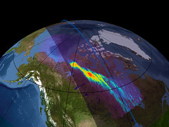
The [Van Allen] belts are a hazard for artificial satellites and moderately dangerous for human beings, difficult and expensive to shield against.

There is a proposal by the late Robert L. Forward called HiVolt which may be a way to drain at least the inner belt to 1% of its natural level within a year. The proposal involves deploying highly electrically charged tethers in orbit. The idea is that the electrons would be deflected by the large electrostatic fields and intersect the atmosphere and harmlessly dissipate.


Besides that I personally can't imagine the risk we'd be taking by making such a huge change to the makeup of space just outside our atmosphere (can some of you more astronomy/science-minded folks chime in?), I wouldn't want to lose the auroras!

Thursday, June 25, 2009

Argentina's Coast


Argentina Coast
Originally uploaded by robmcmanus83.
Sara K. Smith teaches us some Argentinian geography as inspired by South Carolina's Governor Sanford: "Sanford Taught Us All a Valuable Lesson in Geography."

And I had no idea. I have a rough visual picture of the geography of South America, where the plains are, and the glaciers, and the rain forests, and plateaus, and high Andes, and the Pampas. But I'd never even thought of the coast of Argentina, and whether it is accessible, whether it has a long coast road like California's, or is developed like the French Riviera, or is broken up and swampy like Louisiana's, or an open estuary like South Australia's Coorong, or a series of sand bars and barrier islands like South Carolina.

Now I know a little more, and of course, must read up a bit. I am fascinated.

Wednesday, June 24, 2009

I wonder what details he's staring at

This is how I grew up, on my belly over the National Geographic Atlas, or the Times Atlas, noting changes in the various borders of Africa and Europe, or stopping in front of wall-mounted maps to stare.

I still do it. Nothing's changed, in more than four decades now. Maps make me stop and inspect the details.

stretching the bounds of geographilia

I know this blog is about geography. Every so often I grumble about what the outside edges of "geography" are. It's a broad subject, indeed. Human geography is huge and vague around the edges, physical geography is only slightly more concrete. I love the range of the science.

It really doesn't include astronomy, and I battle with that in my brain, because astronomy fascinates me too.

Steph gets around it with her blog title, Adventures in Earth and Space, as she's a geologist who works with NASA.

I throw up my hands here, I don't care, because I want to share with you these children's drawings:


Astronomy des petites - Kids' astronomy


I do not promise I will never say anything about astronomy again.

(click through the photo to see the whole set on flickr)

Tuesday, June 23, 2009

dodge the blast wave!

I saw this wonderful picture of Sarychev volcano (in the Kuril Islands, erupting on June 12) yesterday or the day before, but it's been a busy few days with gardening (I got the rest of the potatoes planted, and damn these cucumber beetles that just don't squish easily) , and my "I need to blog about this wonderful photo" kept becoming, "As soon as I get a minute...." because I intended not just to share the picture, but explain what was happening.


Then Andrew Alden at geography.about.com did what I'd intended to do, and explained the details, so I can quote him gratefully.
The eruption plume consists of brown ash. The white cloud cap formed in the air pushed upward by the rising plume in the cold stratosphere. It is a pileus cloud (named for an ancient Greek hat), now being penetrated by the eruption plume. The big ring of clear air around the island formed as the air around the plume moved downward in response. On the ground, three ashflows are moving down the volcano's slopes. The one on the bottom appears to be white with steam.
And here is it, caught on camera by folk in the International Space Station, for science, and for our delight.

(Yes, the title's silly. It's what my husband says every time an action movie hero narrowly escapes being blown up by ducking away from or fleeing ahead of an explosion's blast wave.)

careers in geography


(This is part 32,208,498,408 or so in a series of videos that I try not to post more than once every couple of weeks, because they aren't mind-bendingly interesting, but seem to have some good information.

Monday, June 22, 2009

sharing the wealth


FIVE SEA LIONS
Originally uploaded by SparkyLeigh.
"A sea lion was picked up by Oakland police Monday morning after it wandered onto northbound Interstate Highway 880, a California Highway Patrol officer said.
The sea lion was spotted around 5:45 a.m. as it walked south in the center divide of northbound I-880, just south of Park Street, the CHP reported.
"

The CBS blog goes on to say that there have been more malnourished babies coming up out of the bay lately, and that their prey is decreasing locally.

Protecting fisheries and choosing sustainable seafood protects sea lion food, too.

The Monterey Bay Aquarium's Seafood Watch program offers printable sustainable seafood guides and lists of good alternatives for non-sustainable favorites.

We're sharing that big ocean full of meat (and vegetables now, too) with lots of other creatures. We need to find a way to share it fairly, and to save it for the future as well.

Saturday, June 20, 2009

For everything - turn turn turn


Sun rising between stones
Originally uploaded by KimM-O.
Time for the sun to swing back to the south again, bringing light to my friends Beatrice in Argentina and Miche in New Zealand and Den in Australia, though we're still in "sun slow" on the analemma, so it'll be awhile before my days seem much shorter, or theirs much longer.

Still, here we are again, marking a point on the trip we take every year, swinging round and around the sun, living in the endless pattern.

Thursday, June 18, 2009

Pin the tail on the city


Tehran and Milad Tower (HDR)
Originally uploaded by arash_rk.
In response to a general question about how many people in the west (more specifically, Americans on twitter who turned their icons green) could even find Tehran on an unlabeled map, my friend Rick came up with a challenge meme, of a sort, suggesting folks start with a fully zoomed out, unlabeled google map, then zoom in toward Iran until you think you can click on exactly where Tehran is, then click, and announce what city you ended up on, if not Tehran. (If you ended up right on Tehran? Woohoo!)

So, where did you end up? If it was Tehran, how close did you zoom in before you could be precise?

Where do you come from, and what's your geography background like, or your knowledge of central Asia?

I ended up about 100 km northeast of Tehran, from just far enough above the surface that what I thought was city was bare rock.

on my honor I will try


Thanks to my friend Lisa for pointing me at these badges.

(Admittedly, I only claimed the kid science one because these weren't available when I was little.)

Tuesday, June 16, 2009

FOR SCIENCE! ... and for beauty

This looks so completely CGI I can hardly blame people for assuming it's not real:


Yes, this is on youtube, it might go down some day. Unlike NASA, the Japanese space agency JAXA retains rights to its images. But they don't seem to enforce that too hard.

I don't really expect I'll get to see the earth rise from the moon, I'm old enough now that I'll likely be dead before the general public gets to visit. But I'm still glad we're interested enough in pure science to explore it, and I'm glad there are people who record it on video and share it for us for the sake of beauty alone.

Monday, June 15, 2009

longitude and latitude -- basic school video

very very very basic explanation of longitude and latitude:

Sunday, June 14, 2009

nice time-eating little map puzzle

US Map Puzzle -- Drag the states into their proper places using the Great Lakes as a placement guide.