Friday, September 03, 2010

Christchurch earthquake pictures


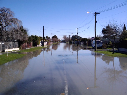
Christchurch earthquake
Originally uploaded by johnstewartnz.
(way down at the bottom are quake preparedness commentary and a video)

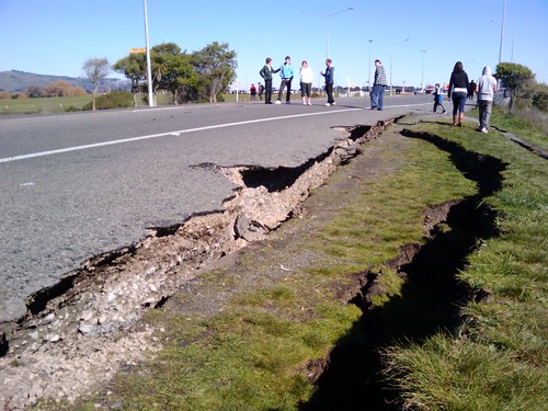
Earthquake!

Earthquake!
(Look at that vertical displacement!)
(edit: A couple of friends have since reminded me that "displacement" is a specific geologic term with regard to quakes. This offset might not be ground displacement as much as separation due to liquefaction or localized sinking.)

Earthquake!

Earthquake!

Earthquake!
(above photos by digitalsadhu

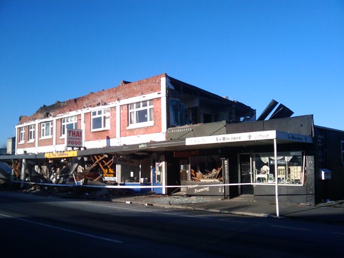
Christchurch earthquake

Christchurch earthquake

Christchurch earthquake

Christchurch earthquake
(above photos by John Stewart

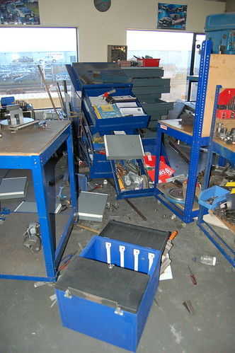
Christchurch Earthquake Works a mess

Christchurch Earthquake Works a mess
(above photos by Brendan Gloistein


After I looked at these, I reminded my husband that we haven't replaced the attachment hardware for our bookshelves, so we'll do that this weekend.

We also need to re-inventory our quake kit and find out what we need to replace. My favorite list of supplies is sfgate.com.

Folks from Christchurch respond to last night's big quake:


The panicky woman couldn't have known then (and many folks don't know, in general) that the quake wasn't really big enough for a tsunami, especially given as it was centered under land. They're usually from bigger quakes centered under water, with specific seismological conditions. But when the ground has bounced you out of bed in the wee hours of a winter's morning, that's probably not your first thought.

there's a lot going on down there

It's not exactly as good as being on the ISS, but it's still amazing:


Timelapse of Earth from low orbit. The lights below, the aurorae, just lovely. I want to lie in the cupola and stare.

Thursday, September 02, 2010

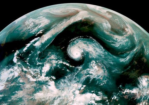
Earl: Now, in AQUAVISION

Aquavision-Hurricane-Earl-20100902-0000Z

Oh, how neat is this? The blue shows water vapor, or as the caption states:

Aquavision False color image from GOES-E Satellite taken on September 2, 2010 0000 UTC.

RGB[IR4, IR2, WV] composite. In the image Category 4 Hurricane Earl moves northwest towards a frontal system draped across the North America that had deformed in to a straight wall. The blue water vapor outflow of Hurricane Earl swoops down to the SW, while the overall flow of the frontal system moves water vapor from the tropical system near Baha California up towards Greenland.


Image credits: EUMETSAT / NEODASS / DSRS / NASA / processing by Mike Malaksa

A beer company chimes in on saving the Colorado

And I find this just as a friend from New Mexico tells me of some rather horrible water conservation mayhem in her neck of the woods, so I'm going to get on top of some research -- oooh, content. This blog might have content!


(Note: On a scale of NSFWness, this is a 3 on a 1-10 scale, where 1 is Mister Rogers.)

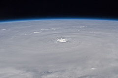
Hurricane Earl from Space

Hurricane Earl takes up a huge chunk of planet. Regardless of whether the eye makes landfall -- and it still seems likely that the track will curve to the north then east, and miss land -- this is going to make one heck of a stormy Labor Day Weekend on the east coast of North America.

Thursday, August 26, 2010

Crescent Moon


Crescent Moon
Originally uploaded by lrargerich.
‎"The Church says that the earth is flat, but I know that it is round, for I have seen the shadow on the moon, and I have more faith in a shadow than in the Church." — Ferdinand Magellan

Tuesday, August 24, 2010

Cotopaxi volcano


What a lovely Milky Way, just rotating right over the top of it!

(Found via Lane Hartwell, a local photographer.)

Sunday, August 01, 2010

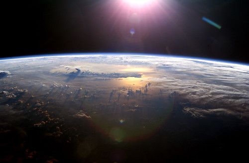
Earth from the ISS, cloud shadows

"From space I saw Earth,
indescribably beautiful
and with the scars of national boundaries gone."
Muhammad Ahmad Faris, astronaut

Saturday, July 31, 2010

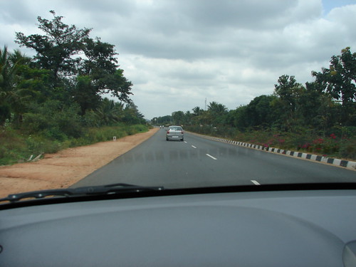
Ah, India

Bangalore to Mysore distance by road is about 140 kilometers. The approximate driving time is 3 hours, including a short brake in between.

En Route to Mysore on the Bangalore - Mysore National Highway

Thursday, July 29, 2010

orographic terminology

My friend Joe asks a specific cloud question:

Joe: Okay, an earth sciencey sort of question for you. In greenland I often saw cloud formations that sort of formed a belt half way up a cliff, e.g.,


Roughly speaking, my question is "does that have a cool name?" and "what's up with that?" Okay, that's two questions. :)


Can you explain? Is there a name for that kind of cloud position/type?

(I did tell him why the cloud formed there - but beyond that, I know not.)

Joe's going back to Greenland in a few days to take more pictures. Check out the rest of his Above the Arctic Circle work, -- he's good at making geography visible.

Wednesday, July 28, 2010

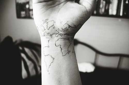
Maybe I need a geotat theme blog


Another geotat off tumblr.

In Santa Cruz, once, I saw someone with California on his entire right arm, Lake Tahoe at the elbow, etc. Seeing it move was weird, especially as there aren't any fault that make the state move just like that. ;)

And if you like tattoos, you should definitely check out Carl Zimmer's Science Tattoo Emporium!

Monday, July 26, 2010

way slow lightning


Watch the timestamp move. The whole video is slowed down to 1/300 speed.

It's interesting to watch the big bolts form, and disappear, but I am in love with all the tiny baby bolts.

Saturday, July 24, 2010

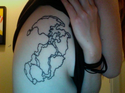
I love this tattoo so much I could pop


The caption on the tumblr page says,
"pangaea. hoping it will stretch into it’s current positions as I get older and fatter."

Oh yeah. :D

(Note: This is not ink on me. I found it tumblrward.)

Thursday, July 22, 2010

Tuesday, July 20, 2010

2009's Atlantic/Caribbean tropical storms, all at once

NASA and NOAA have put together a four-minute time-lapse animation of the 2009 hurricane season:


I find myself trying to peer beyond the bottom right corner, to see what's going on between the Caribbean and Africa.

At least as interesting as watching the tropical depressions form and move, though, are the way clouds form over Central America. I'd like to watch a time lapse of Panamanian skies from the ground below, based on this.

Saturday, July 17, 2010

Galilean thermometer in the sun

My friend Den posted this pretty danged awesome time-lapse video of a Galilean thermometer slowly warming up and moving in the sun.

I have no idea how these work. Are you willing to explain to me, or shall I look it up? ;)

Friday, July 16, 2010

the sky is falling

Here's some fascinating video from Yosemite Park, showing and discussing the process of rock falls:


Geologists discuss the rock falls, and their effect on park visitors, and there's some great video from a park visitor.

The video's a granite-lover's dream, with obligatory spectacular views of Yosemite as well.

I'm feeling less inclined to scramble in the talus looking for pikas than I might once have been.

Does the information in this video affect how you would use Yosemite, or whether you would visit the park or similar areas?

Saturday, July 10, 2010

it's like alabaster

What a lovely photo of our moon. When I was little, I thought the daytime moon was translucent, like the little alabaster elephant lantern my grandmother had on a table in the hallway.

Tuesday, June 29, 2010

death by clam?

That's a horrible and fascinating phrase.

I have no idea when this short National Geographic web exclusive on Hulu.com will last, but it's here now:


I'm a big fan of molluscs, I find them endlessly fascinating. (I also find them occasionally tasty. I'm about 99% vegetarian, but small bivalves rock my culinary world.)

I didn't really know much about giant clams. I guess I assumed that they lived in the deep sea (they don't), and that they were a lot like large versions of normal clam species. But they have nifty skin not unlike a squid's (less shiftingly chromatophoric*), and I had no idea about their relationship with algae!

Also, let it be said that the diver at the end of this clip is a doofus. Don't go messing with sea animals or coral reefs, Doofus Diver.

*It's amazing what blogger labels as incorrectly spelled. What, that's not a word?

Monday, June 28, 2010

I am surrounded by bad influences


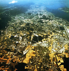
cern_aerial
Originally uploaded by riowight.
My husband and his friend Andy discuss CERN placement:
Andy: I wonder why it's specifically on the French-Swiss border.
Casey: Probably more to do with geography than politics
Casey: CERN is a pragmatic bunch.
Andy: I mean, won't that sloow the particles down? They have to whip out their little particle passports and go through particle customs twice per loop.
Casey: Sorry, didn't see the joke coming, you must have sent it faster than the cluons could reach me.

Friday, June 25, 2010

Around the world

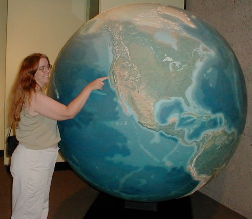
Found via Design is Mine, a gorgeous collection of globular glory.


I spent hundreds of hours in my childhood poring over globes. I loved the relief globes best, ours at home was worn over the Alps and Andes and Himalaya and Rockies where I'd run the tip of my index finger over the ridges time and time again. I'm currently smitten with a globe I saw in a catalog a couple of years ago that has your basic political map on it until the light inside is turned on, when it becomes a star map. Our local plastic-epoxy-and-stuff store, mostly used by sign-makers and fiberglass-molders, sells inflatable globes that are only so much vinyl and poppable, disposable stuff, and what would I do with one? But I want one.

I think my favorite globe-fact, over my life, has been that if the relief on my favorite kind of globe were true scale, I wouldn't be able to feel them.

Monday, June 21, 2010

Get under the pool table, dude


It goes dark, but listen to the end, or almost to the end. I'm not sure I'd be as copacetic.

Sunday, June 20, 2010

Solstice is serious business

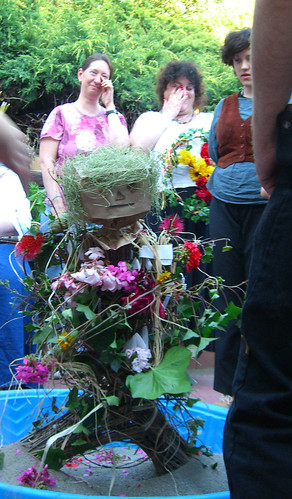
Four years ago, at a friend's Solstice celebration, I caught a shot of my dear friends Kimberly and Sue trying so hard not to giggle during a quiet moment that they were nearly crying.


How could they explain that from their angle, they could see a cat trying to find a use for the sand in the bottom of the straw man at the center of the ritual?

The cat, apparently, had missed the memo about rituals being serious business.

Thursday, June 17, 2010

Multitouch Mapping Exhibit at Oakland Museum of California

The Oakland Museum of California has been one of my favorite places since I first visited in the eighties. It's always been a relatively simple, lovely, open museum, with a California focus. The top floor had art from California artists, sculpture and furniture and huge, gold-framed oils showing Yosemite waterfalls in the 1800s. The second floor was a rather overwhelming but comprehensive walk through California history.

The bottom floor, my favorite, was all about the California natural history, the river otters and acorn woodpeckers and bivalves in the bay mud.

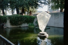
There was a gigantic relief map, and a huge whirling globe (in my icon!), and outside a koi pond with a big acrylic sculpture in it.


The green central (roof?) area sometimes hosted musical events, small festivals, wine-tastings. The lecture halls had a regular schedule of California-relevant educational events. The cafe was lovely, inexpensive for fairly good food, with a window above the pond, looking out into the peace.

Then it closed for awhile, for a deep remodeling. At first I was fussed that I couldn't attend, then I sort of forgot about it. When it half-reopened (the natural history section is due to open next year), I sort of forgot to go back.

Looking around for maps on Flickr tonight (I am a special kind of nerd) I found this little video about Ideum's interactive historic map display at the museum. OMG. The internet is indeed for (map) porn. I'm checking my schedule for the next week or so to find out when I should go to the newly reopened Oakland Museum of California.

Wednesday, June 09, 2010

The Raging Grannies have an opinion

Okay okay one more! But I promise content just as soon as I finish dinner dishes.

srsly


1999 ad.

Now I need to get working on content. Too much fluff and image-linking lately.

Ah, Kansas


(Yes, I know this is from the Onion. But still, Kansas. And Texas. Nuff said.)

Sunday, June 06, 2010

Irony


(via MoveOn on Twitter)

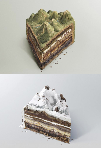
geocake!

Oh, the things we find on Tumblr!


Geocake!

I'm back from vacation in Alaska and will write some bloggy stuff about it very soon, as soon as I rest.

That might be as soon as the SF Bay Area gets over this uncharacteristic combo of heat and humidity.

Saturday, May 15, 2010

Wednesday, May 12, 2010

This oil leak is almost exhausting to think about

Oil and gas stream from the leaking well in the Gulf of Mexico:


Of course, this is wreaking havoc on animals and ecosystems in the area. Tuna have no eyelids, you know? They can't protect themselves from the oil. Dolphins and birds are becoming hurt, many are dying.

There are many ways to help, including advocating for an end to offshore drilling, for alternative energy sources, and by working to help clean up beaches and marshes, and to take care of animals.

Here's one:

Tuesday, May 04, 2010

layers on blended layers

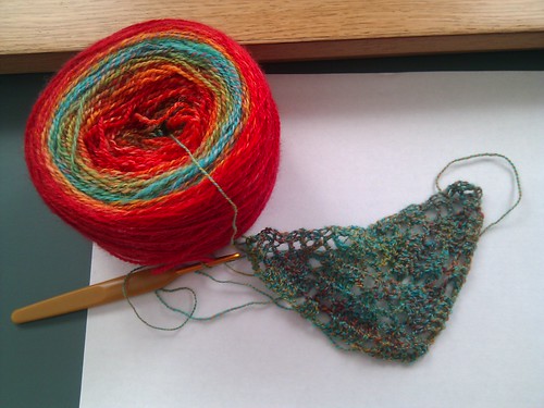
I've had this picture of my friend Heather's yarn up in a tab for hours because I keep coming back to stare at it. It reminds me so much of the layers of the Earth.

Sunday, May 02, 2010

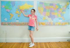
Geography Girl


Geography Girl
Originally uploaded by brentdanley.
I love that this geography picture keeps getting new notes appended. It reminds me of my urge to decorate a family room in maps, with globes and orreries and and old navigation tools everywhere.

Now all I need is my own family room, with a house to put it in.

(Click through to the photo on flickr to add your location to her maps.)

Saturday, May 01, 2010

World back-up


World back-up
Originally uploaded by Daniel Montesinos.
Randomly found while looking for old California maps. I have nothing to say about this (except that I'd spend my life having detail added).

Friday, April 23, 2010

earth-shattering kabooms!

Brian Romans, from Clastic Detritus, pointed out on twitter that in recent Icelandic volcano footage, one can see amazing shock waves propagating through the ash cloud after explosions.

Wow! The air vibrates beautifully. Have a look. It happens several times in this video.


Wikipedia says, incidentally, that
The name Eyjafjallajökull is made up of the words eyja (genitive plural of ey, meaning eyot or island), fjalla (genitive plural of fjall, whose nominative plural is fjöll, meaning fells or mountains) and jökull (meaning glacier, cognate with the -icle in icicle). A literal translation would thus be the "island-fells glacier" or the "island-mountains glacier". The name Eyjafjöll describes the southern side of the volcanic massif together with the small mountains which form the foot of the volcano. The village and museum of Skógar are also part of the region undir Eyjafjöllum (meaning "under the Eyjafjalls").
So it's Eyjafjöll that's erupting? It's complicated.

so much left to explore


(as usual, there's more to the comic if you click through and mouseover for the alt text.)

Thursday, April 22, 2010

our tiny world

I had the opportunity and pleasure today to listen to a live-streamed lecture from Professor Brian Cox, at Manchester University, about the LHC, exploring space, and curiosity-driven science.

He talked about the LHC, and the math involved in research of subatomic particles, quarks, Higgs, a little about electromagnetism. He pointed out Earth in one of my favorite solar system photographs.

He reminded his listeners that it's important to know why we're doing what we're doing, and that for him, like for Sagan, one must start with the beauty and wonder, then get into the details as part of that. Richard Feynman was another scientist who held that mastery, who was delighted at the world, the universe, and for whom science was an expression of that delight.

Prof. Cox wound down his lecture with this, from Carl Sagan, who was responding to a photograph taken from Voyager, as it looked back on the solar system it had just traveled through:

From this distant vantage point, the Earth might not seem of particular interest. But for us, it's different. Consider again that dot. That's here, that's home, that's us. On it everyone you love, everyone you know, everyone you ever heard of, every human being who ever was, lived out their lives. The aggregate of our joy and suffering, thousands of confident religions, ideologies, and economic doctrines, every hunter and forager, every hero and coward, every creator and destroyer of civilization, every king and peasant, every young couple in love, every mother and father, hopeful child, inventor and explorer, every teacher of morals, every corrupt politician, every "superstar," every "supreme leader," every saint and sinner in the history of our species lived there – on a mote of dust suspended in a sunbeam.

The Earth is a very small stage in a vast cosmic arena. Think of the rivers of blood spilled by all those generals and emperors so that, in glory and triumph, they could become the momentary masters of a fraction of a dot. Think of the endless cruelties visited by the inhabitants of one corner of this pixel on the scarcely distinguishable inhabitants of some other corner, how frequent their misunderstandings, how eager they are to kill one another, how fervent their hatreds.

Our posturings, our imagined self-importance, the delusion that we have some privileged position in the Universe, are challenged by this point of pale light. Our planet is a lonely speck in the great enveloping cosmic dark. In our obscurity, in all this vastness, there is no hint that help will come from elsewhere to save us from ourselves.

The Earth is the only world known so far to harbor life. There is nowhere else, at least in the near future, to which our species could migrate. Visit, yes. Settle, not yet. Like it or not, for the moment the Earth is where we make our stand.


It has been said that astronomy is a humbling and character-building experience. There is perhaps no better demonstration of the folly of human conceits than this distant image of our tiny world. To me, it underscores our responsibility to deal more kindly with one another, and to preserve and cherish the pale blue dot, the only home we've ever known.


I was going to put together an Earth Day post today, and I might still -- it's a busy day, I wasn't prepared ahead of time.

But I think that Sagan had it all, right there. The rest is just detail, it's about how to do it. That's what I'll get into later.

Monday, April 19, 2010

Friday, April 16, 2010

happy tinkling lava

It's flash, so I can't embed it, but just *listen* to the cooling lava tinkle like broken glass as it falls off the face of the flow:
Awesome volcano video, not so pleased about non-embeddable flash, but heck, it's a Canon ad, no?

This (radar?) image from April 15 looks ominous:

Thursday, April 15, 2010

Playing with the Devil


Playing with the Devil
Originally uploaded by skarpi.
Yahoo has very cleverly made a "yahoo editors' picks" account on flickr to organize pictures in galleries.

These are their favorites for the Iceland volcano:
http://www.flickr.com/photos/yahooeditorspicks/galleries/72157623855495574

Goodness gracious

Dan Satterfield linked on his facebook page this news video of the meteor that lit up the midwest last night:


The Christian Science Monitor (which has a great photo of the fireball) says
A large flash of light at about 10 p.m. Wednesday night – described as a fireball in the sky by eyewitnesses from Wisconsin to Missouri – was most likely a meteor from the ongoing Gamma Virginids meteor shower.
It is unknown whether the meteor in Wisconsin, which was seen flying eastward at an altitude of 6,000 to 12,000 feet, hit the ground or burned up in the atmosphere.
There's more at that link.

Updates on the European ash situation

From AlJazeera, an information-filled and relatively accurate story (text story at that link) about the effects of Eyjafjallajokull's eruption:


The BBC has more too, on their site, including this important tidbit: "The UK's air traffic control service (Nats) said no flights would be allowed in UK airspace until at least 0700 BST on Friday amid fears of engine damage."


Today's ashcloud from space:


Because the clouds make it hard to see a visible-light photo, the Norwegian meteorological office released this one


(I'm a tad embarrassed to ask: What wavelength is this? not infrared.)


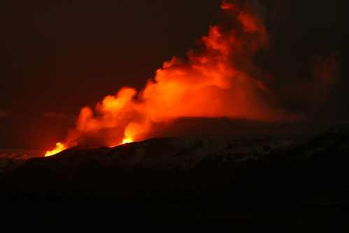
The glow from the ground:

Eyjafjallajokull volcano still erupts dramatically

My initial reaction was actually (in text, to a friend), "omg omg omg omfg geology."


Right now, several airports in Europe (specifically Norway and the UK) are closed because of ash.

Boston.com's "The Big Picture," one of the best photoblogs on the web, collected pictures of the volcano and its effects today. Some aren't the usual fare, some are especially dramatic, but I think one that most caught my eye was #11 - people in snow gear, standing on dirty snow with ski poles stuck in it, watching flowing lava from a few feet away.


(And for the sake of fun: KCBS said, on twitter: "Why we're just calling it 'a volcano in Iceland'. Try saying this: Mt. Eyjafjallajökull (ay-yah-FYAH'-plah-yer-kuh-duhl)" Wikipedia provides the IPA [ˈɛɪjaˌfjatlaˌjœkʏtl̥]) and an audio clip to unconfuse things.)

Addendum: My friend Ailbhe, in the thick of things, clarifies the current airport closure and flight diversion issues -- "UK, Ireland, Norway, Sweden, Denmark, north Finland, Belgium, north France, the Netherlands in parts" -- and provides a link to a good reason: Volcanic ash destroys airplane engines catastrophically.

Sunday, April 11, 2010

Fascinating Northridge quake coverage

I did spot one major technical/factual mistake, though.


(Have I posted this before, years ago? I should look. But it's a cold, rainy morning, and the dog is asleep on me, and that sounds like a lot of work for today.)

Friday, April 09, 2010

Monday, April 05, 2010

Whoa, earthquake


(Clicking through, of course, gets you to the alt-text for the comic, which you can mouseover for more info, and/or humor.)

Sunday, April 04, 2010

7.2 quake in Baja California today

What scientists are guessing so far:
The fault that triggered the quake was probably located on one of the many faults south of the San Andreas fault, [seismologist Lucy] Jones said. The fault is probably about 40 to 50 miles long, and probably shook for 20 to 30 seconds. The worst shaking would have occurred closest to the fault, said [seismologist Lucy] Jones .

She said scientists would not have enough information to identify the fault until geologists survey the area.

The quake occurred at the junction between two tectonic plates, the Pacific and the North American, that grind against each other through Baja California and California. The quake is probably on a strike-slip fault, which splices through the ground vertically and causes land to move horizontally.


Earthquake damage in Mexicali, Baja California!!!! on Twitpic
A house collapses in on itself in Mexicali.

#terremotoMexicali transformador caido en Manuel Peña y Emil... on Twitpic
A telephone pole pulls wires down in Mexicali

Share photos on twitter with Twitpic
Cars drive over a slightly buckled road in Mexicali

#terremotoMexicali Edificio Excomex. on Twitpic
Commercial buildings crumble slightly in Mexicali

Share photos on twitter with Twitpic
A picnic area shifts dramatically

Share photos on twitter with Twitpic
In Ensenada, a twitterer's laptop sits open in front of gaping wall cracks. (Note Tweetdeck open, perhaps following the news.)

Share photos on twitter with Twitpic
And in El Centro, California, a family's deck lies in their back yard. I thought we had better construction standards than that!

Animation: Dust (or smoke? probably dust) rises from the Mexicali area following the quake

More news is coming in, of course, the "did you feel it?" map is still changing. The quake was only 10 km deep, and I have no doubt we'll hear about more damage than is known so far. As quakes usually are, this one will be another learning experience.

Saturday, April 03, 2010

Science communicators are climate heroes

The general public really needs a good bridge between sometimes complicated science and what we are able to assemble into a useful picture. Clear, simple, fact-rich science communication is essential, good science communicators are priceless anymore.

That's why Dan Satterfield is one of my favorite science communicators. He's direct, smart, and really gets to the point, understanding what his readers need filled in. His most recent blog post really makes that clear to me. Dan goes step by step through not only the reasons why climate change is now scientific reality (with some amazement at the TV weather people who dismiss it as myth), but he also insists its the TV meteorologist's obligation to sort it out for the watchers, for the folks at home whose only exposure to real scientists and balanced science throughout the day might be what they get from their trusty TV weatherguy.

Dan's also just plain good folks. But he's good folks with a sharp mind, and the kind of understanding of his audience (both for his blog, and on TV in Alabama) that teaches rather than preaches, that informs rather than lambasts, that gets the point across in the way we need right now.

He's the kind of science communicator that we can point at as part of the solution to the problem. When you hear people saying, "If only we could communicate science to the masses," point them to Dan's blog, and say, "You mean, like that?"

Friday, April 02, 2010

frazil ice in Yosemite National Park

Steven Bumgardner, who produces Yosemite Nature Notes for the National Park Service, shot some video of "frazil ice" on the Merced River in the park this week, as a cold early spring storm moved across California.


I'd never heard of frazil ice before. Now, because I must look things up compulsively, I'm learning about it. Wikipedia says, "Frazil ice is a collection of loose, randomly oriented needle-shaped ice crystals in water. It resembles slush...," which probably explains why I'm imagining margaritas. And Hajo Eicken at the Geophysical Institute at the University of Alaska, Fairbanks, says
The word frazil means fine spicules or blobs, which gracefully describes the morphology of the crystal. Sea ice growth always begins with frazil ice production, the only true dendritic ice growth phase. Active convection aids sensible heat transport at the ocean surface, thereby super cooling the water and allowing dendritic growth of ice crystals.
This is so cool. Spicules and blobs. Scientific terminology rocks. ("Dendritic," of course, means it's like branches of a tree, like drainage in a river delta, or the shape of a neuron.)

The waterfalls of Yosemite must be delightful just now.

Monday, March 29, 2010

The shaping of the Great Lakes, in an hour

The History Channel's new series, "How the Earth was Made," is mostly just scientific enough for me today, as I'm fighting a low fever, and wanted to stare at something educational without spraining too many neurons. Today I sat down with Hulu and watched an episode about the creation of the Great Lakes.


I knew some of it, such as the glacial history, but hadn't known about the igneous origins of the floor beneath Superior and Ontario. The series is presented in steps, giving evidence for theories (with a bit of the History Channel's typical "but that's not all" and "there's more they didn't know," and "but still, mystery remained" drama), then before each ad, recapping the bits. I appreciated those, it helped me knit the story in stages before going on to the next chapter in the story.

As it turns out, I had no idea how fast Niagara Falls was receding. Do you know? What would you guess? Watch the show and see. I was a tad stunned.

(If the Hulu.com video expires, you can find the video for sale at the History Channel website, with a few clips and full episodes still available.)