Friday, July 25, 2008

State of Self-Determination


State of Jefferson
Originally uploaded by Lynda True.
I grew up in Northern California hearing the story of the State of Jefferson as a folk tale that was true, a bed time story, the tale of a semi-serious (depending on whom you ask) secessionist movement among seven(ish) counties along the Oregon-California border.

The area isn’t new to secessionist movements. They began soon after California (itself born of a secessionist movement of sorts) became a state. While it started as a bit of a stunt, eventually, a few counties took it seriously. There is a core State of Jefferson now, in the minds of people who lived there, or live there, and remember; with the few original states, but some people consider a broader range of counties to be part of it now, because of similarities of politics, economy, demographics, and other factors (even as far to the southwest as Mendocino County, for instance). The modern boundaries of Jefferson are vague, having shifted as the focus of the movement itself shifted from a political gesture to get attention for the area’s development and economic needs to a true (if weakly supported) secession movement, to an attitude, an independent, somewhat libertarian desire for autonomy.

The New York Times reports on a similar historical movement that I hadn’t heard about before, Absaroka:
Hold up the map today that "Governor" Swickard and his compatriots sketched out . . . and the distinctions that made this part of the country feel worthy of statehood in the 1930s — different in its geography, history, economic base and political outlook — are mostly still there.
The undulating landscape of tall grasses that shaped the horsemen and women of the Sioux, Cheyenne and Crow, and the ranchers who came later, is still there, in all its lush exuberance. Economic life shifted gears — coal-bed methane and hobby ranching encroached, sugar beets and flour-milling fell away — but the high grass persists, and that defines the land and the culture — then and now.
"The grass culture — people who make a living from growing grass, or from the animals that eat the grass — that was Absaroka," said Ken Kerns, a 76-year-old rancher who has lived most of his life on the Double Rafter Ranch . . . .


The article goes on to describe the people of the region as "conservative, self-sufficient and wanting mostly to be left alone." This describes the State of Jefferson, as well. It is, in a way, just a utopian movement, for individualist values of "utopia." People want to take care of each other and to use the land the way they see fit, without surrounding (California, Oregon, etc.) laws interfering.


Every time a movement wanders around, before an election, to separate California into more than one state, I think of Jefferson. Sometimes folks want to split California into two states, with the division of the cities and the location of the border moving around depending on who wants to do the splitting. They want Sacramento but not San Francisco, or they want San Francisco but not Los Angeles. Or they want to split it into three, with the rural counties (perhaps with those of the Oregon side of the State of Jefferson) wanting to become self-sufficient, taking care of themselves and the others, and splitting the city folks down below into Central and Southern California.

Mom, Carol, and Grandma in Modoc County            


I can’t imagine this ever truly happening. California is indeed unwieldy, it’s too big. It’s bigger, in size, economy, population, and certainly in arrogance, than many independent nations, and perhaps it would somehow work better split into smaller states – but the ends of the state are so interdependent now that it would be difficult at best.

            Berenice Pate, Modoc County, 1933


The environmentalist in me is pretty sure that the State of Jefferson and its northern California neighbors would have a hard time supporting itself without environmentally devastating degrees of resource extraction, but I’d love to be proven wrong.

Links:
The State of Jefferson
Jefferson Public Radio, one of my favorite stations:
Wikipedia on the State of Jefferson
Strange Maps also discusses Absaroka


More images from Jefferson:


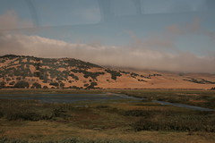
Solano County Hills


Solano County Hills
Originally uploaded by caramida.
This part of the ride is one of my favorite reasons for the Capital Corridor train route. This particular view epitomizes California to me. Other people love the redwoods (as do I) or the beaches (as do I) or Los Angeles ([crickets]) but rolling oak woodlands and grasslands are my home.

These marshes were the first places my family lived when they first settled in California in the 1850s. They moved to other parts of the state not too long after because 1) their house burned down, leaving them with nothing, and 2) typhoid and malaria.

I hope to start a couple of regular features on Geographile: I want to have a weekly post that talks about some part of geography -- mostly California, I imagine, but elsewhere too, other places, and other aspects of geography -- that have a strong emotional effect on me, and talk about why. In addition, I want to start a weekly book review, to make good use of my growing geography (natural history, environmental science, cartography, etc.) book collection.

Thursday, July 24, 2008

One third of the way to the moon -- wow


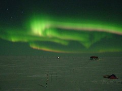
Aurora australis
Originally uploaded by Antarctic M.
Years ago, when I was an exchange student in rural Australia, my host mother woke me in the wee hours, one night, to bring me into the back yard. She pointed off to the south. The sky was full of light, a shimmering green gauze shower curtain, it seemed, billowing in the steam and air currents of the night sky. "This is unusually far north for it," she said, and it was, at about 32 degrees south of the equator.

The aurorae have been mysterious to humans throughout history, but we're learning more -- and the learning doesn't ruin the magic, for me. It reminds me of Richard Feynman's famous footnote within the Feynman Lectures on Physics. It reads like a poem:

Poets say science takes away from the beauty of the stars — mere globs of gas atoms. Nothing is 'mere'. I too can see the stars on a desert night, and feel them. But do I see less or more? The vastness of the heavens stretches my imagination— stuck on this carousel my little eye can catch one-million-year-old light. A vast pattern— of which I am a part... What is the pattern or the meaning or the why? It does not do harm to the mystery to know a little more about it. For far more marvelous is the truth than any artists of the past imagined it. Why do the poets of the present not speak of it? What men are poets who can speak of Jupiter if he were a man, but if he is an immense spinning sphere of methane and ammonia must be silent.


From a NASA press release:

NASA Satellites Discover What Powers Northern Lights

GREENBELT, Md. — Researchers using a fleet of five NASA satellites have discovered that explosions of magnetic energy a third of the way to the moon power substorms that cause sudden brightenings and rapid movements of the aurora borealis, called the Northern Lights.
The culprit turns out to be magnetic reconnection, a common process that occurs throughout the universe when stressed magnetic field lines suddenly snap to a new shape, like a rubber band that's been stretched too far.

"We discovered what makes the Northern Lights dance," said Dr. Vassilis Angelopoulos of the University of California, Los Angeles. Angelopoulos is the principal investigator for the Time History of Events and Macroscale Interactions during Substorms mission, or THEMIS.

Substorms produce dynamic changes in the auroral displays seen near Earth's northern and southern magnetic poles, causing a burst of light and movement in the Northern and Southern Lights.

Substorms often accompany intense space storms that can disrupt radio communications and global positioning system signals and cause power outages. Solving the mystery of where, when, and how substorms occur will allow scientists to construct more realistic substorm models and better predict a magnetic storm's intensity and effects.

"As they capture and store energy from the solar wind, the Earth's magnetic field lines stretch far out into space. Magnetic reconnection releases the energy stored within these stretched magnetic field lines, flinging charged particles back toward the Earth's atmosphere," said David Sibeck, THEMIS project scientist at NASA's Goddard Space Flight Center in Greenbelt, Md. "They create halos of shimmering aurora circling the northern and southern poles."

Scientists directly observe the beginning of substorms using five THEMIS satellites and a network of 20 ground observatories located throughout Canada and Alaska. Launched in February 2007, the five identical satellites line up once every four days along the equator and take observations synchronized with the ground observatories. Each ground station uses a magnetometer and a camera pointed upward to determine where and when an auroral substorm will begin. Instruments measure the auroral light from particles flowing along Earth's magnetic field and the electrical currents these particles generate.

During each alignment, the satellites capture data that allow scientists to precisely pinpoint where, when, and how substorms measured on the ground develop in space. On Feb. 26, 2008, during one such THEMIS lineup, the satellites observed an isolated substorm begin in space, while the ground-based observatories recorded the intense auroral brightening and space currents over North America.

These observations confirm for the first time that magnetic reconnection triggers the onset of substorms. The discovery supports the reconnection model of substorms, which asserts a substorm starting to occur follows a particular pattern. This pattern consists of a period of reconnection, followed by rapid auroral brightening and rapid expansion of the aurora toward the poles. This culminates in a redistribution of the electrical currents flowing in space around Earth.

THEMIS is the fifth medium-class mission under NASA's Explorer Program. The program, managed by the Explorers Program Office at Goddard provides frequent flight opportunities for world-class space investigations in heliophysics and astrophysics. The University of California, Berkeley's Space Sciences Laboratory in Berkeley, Calif., managed the project development and is currently operating the THEMIS mission. ATK Space (formerly Swales Aerospace) of Beltsville, Md., built the THEMIS satellites.

The THEMIS team's findings will appear online July 24 in Science Express and Aug. 14 in the journal science. For more information about the THEMIS mission, visit:

http://www.nasa.gov/themis


Gizmodo has a great animation of the bursts of energy related to the aurora.
NASA has a wealth of other videos.

Wednesday, July 09, 2008

California Wildfires


California Wildfires
Originally uploaded by HawkeyePilot.
What is it like to live with the fear of disaster? How does living with the day to day fear (like my seismophobia, witness a blog entry) compare to that of living with nearby fire, or fire season, or tornado season?

I don't know, really. I can't compare. I've lived in minimal-disaster-risk country. I've lived in fire country (Plumas County, California, and along Goyder's Line in South Australia) when I wasn't aware of fire danger, and when I was only vaguely aware. I don't remember what it was like now, compared to my probably unhealthy, vague anxiety about living right on top of the Hayward fault.


According to research at the National Science Foundation:
"In general, people are familiar with fire and understand a good deal about its mechanics, so fire risks are often underestimated or discounted. In contrast, the unfamiliar, invisible hazards posed by electromagnetic radiation tend to appear riskier and draw more concern and demands for government control."
That doesn't sound quite right to me, but it's research-backed, while my hunches are only hunches. We talk a lot about quakes here in the SF Bay Area. Some of us are vaguely antsy much of the time, some are rational and careful, some ignore any risk at all. But other places I've thought about living -- Portland, Oregon, most usually -- have risks too. Portland's had fierce and dangerous wind, it has the potential for a massive quake (though like on the New Madrid, their quakes are also less frequent than ours), and as California dries out, so will Oregon, and perhaps it will eventually be like central California is now.

Many of us live with risks. Some of us know it. Some are able to ignore it.

California is on fire, this summer. A lot of people are shaking in their boots.

Friday, June 27, 2008

Geography Girl


Geography Girl
Originally uploaded by brentdanley.
The notes and comments on this flickr page make me ridiculously happy!

Thursday, June 26, 2008

Losing California


From Science Daily:
The native plants unique to California are so vulnerable to global climate change that two-thirds of these "endemics" could suffer more than an 80 percent reduction in geographic range by the end of the century, according to a new University of California, Berkeley, study.

Because endemic species -- native species not found outside the state -- make up nearly half of all California's native plants, a changing climate will have a major impact on the state's unparalleled plant diversity, the researchers warn.


(There's much more at that link.)

The illustration they use for this story is a range map for the California Bay tree, Umbellaria californica, one of those trees of my childhood about which I get emotional. I was delighted when Botany Photo of the Day published some of my photos of local bay trees. You can see, in the illustration, how California's island ecology can shape an organism's range. In this case, the deserts of southeast and northeast California and the Sierra Nevada keep the California Bay (which is also called Bay Laurel or Pepperwood in various parts of its range) up against the coast and in the foothills around the valley. That map seems to suggest that with dispersal over the course of climate change (and how would that happen? people?) the range can remain perhaps large, even as range is lost due to change.


In my own head, I've been pondering the future, and whether it makes sense to simply watch some of the endemic organisms of California die off as climate changes, being as it's so much harder for anything to adapt than it used to be -- where will they go? we've fragmented habitat such that animals and annual plants can't move as they used to, and trees shift range slowly even in good circumstances -- or whether they should have human help, being as they'd mostly be displacing or joining organisms who will also need to move as their own climates change. Does it make sense to help move California bay, redwood, douglas iris, valley oaks, and other California-adapted organisms into more hospitable locations for them? Will failing to do so decrease biodiversity across the ranges of what lives in California and Oregon now? What's happening now will affect biodiversity in both areas anyway. The lands north of us will either lose or need to help move its endemic life. Regardless, the richness will become less rich.

Monday, June 23, 2008

California's a little hot right now

The Firefighter Blog links to a June 23 satellite image showing smoke from fires all over Northern California. This blogger says that the remnants of the Wild Fire along the Napa/Solano County line is visible; I can't see it. But I can see columns of smoke rising in Mendocino, Shasta, Monterey, Butte, and Trinity Counties, at the very least. Anywhere structures, people, farms, etc. aren't threatened, the fires are being left to burn, which makes a lot of sense given how California's ecosystems evolved to be healthier in the presence of fire. After this last weekend of dry thunder storms, most of the fires are lightning-started, but at least one of the big fires this past week was an arson fire.

Aside from the alpine and northwest corner rainforest ecosystems, California's endemic plant life is fire-adapted. Once manzanita is 15 or 20 years old, it's unhealthy. When fire approaches, it bursts into flame; after a fire, the manzanita regrows, healthy and young, from the rootstock. Bishop pine cones open properly only in real heat. I once took part in a seedling-count for a study of plant regeneration after the Vision Fire on Point Reyes. There were many times -- in places, ten times or more -- more Bishop seedlings under burned trees than in unburned areas, in April, because Bishop pine cones open in heat, open when fire is burning under them. In fact, on the whole, the burned out areas are healthier than ever. Redwood trees seed on bare mineral soil, but shed a lot of duff. Their seeds sprout best on soil that's been brought to bare dirt by flood or fire. We need to burn here. But with so many people in wooded and brushy areas, now, we can't let every fire burn, and some of our wildlands have had fire suppressed for so long that when they finally burn, it will be with devastating heat and height.

California's a beautiful place, but here, nature seems to like to remind us we're not in charge, and only sometimes know what we're doing.

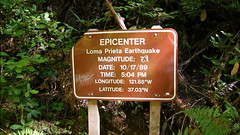
Loma Prieta Earthquake Epicenter

Joe found this sign (and didn't photograph it, but found a pic on flickr) while out hiking yesterday. Someone has corrected the originally reported intensity, and Richter measurement, 7.1, to the Moment Magnitude measurement, 6.9.

He pinged me in IM: "That wasn't you, right?"

No. That wasn't me. :)

Friday, June 20, 2008

Happy Solstice, everyone!


Sundial Bridge
Originally uploaded by Helioscribe.
I'm a bit of a dork, and wanted to share this today, especially:

World night/day clock. Of course, I'm posting this while the curve is as horizontally flat as it can get, but it will change over the next six months until it has two near-vertical lines.

I'm a skeptic/atheist/agnostic, really, but without theism, I'm still very emotionally and spiritually tied to how the cosmos, the solar system, and the earth all works together. I don't need to have a supernatural point of view to think solstice is really cool.

I love loving the earth, and marveling at it, and I like to hang out with people who feel the same way. I love the universe on its grandest scale, I love the interactions and lifecycles of the galaxies and stars. I love the history of the solar system and the earth, and the intricacies of meterology, and the story behind glaciation. I love the compostion of sand on a beach. I love that solstice matters to people.

It all works together. It feeds me.

How do you feed that side of yourself?

The image is a looking-up shot of the Sundial Bridge, in Redding, California. The bridge is near where I grew up, alongside the park where I spent most Independence Days, running around on the grass, finding the dunking booth, and after sunset, watching fireworks over the river. There was controversy and cost over-running and fuss about its being built, and it was possible to wreck a pretty stretch of river with that bridge, but they did good.

When I was little, I watched Redding grow from 10k to 20k people through annexations and population growth. Now, with more annexations, and more population growth, there are about a hundred thousand people in Redding. I don't like the effects of the sprawl, with oak woodland mowed down for parking lots and housing tracts, and the local lakes and rivers taking a water quality blow. (Water quality started to suffer 150 years ago, when the first mines were put on Sacramento River tributaries.) But I'm glad that if they have to grow, they're growing with some style and elegance, and a nod back to the earth.

Thursday, June 12, 2008

It's an "interesting" year, weather-wise

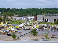
When I'm reading a story that's actually making me cry (about a tornado hitting a boy scout camp and killing four boys, but also about the way the scouts handled themselves in the aftermath), it's really a cognitive disconnect to laugh out loud to read that the building that was destroyed at Kansas State University in Manhattan (KS) was the wind erosion lab.

In all seriousness, yesterday's tornado outbreak was horrible, and it's looking already to be a fierce and memorable and tragic year for tornados in North America.

Wednesday, June 11, 2008

How Crater Lake was formed, in four parts

Swiped from Green Gabbro. Totally.


(more detail)

Crater Lake is one of the most beautiful places in the world. It's a bit off the beaten track, but worth your trip. Bring your camera. In the winter, bring your cross-country skis.

Thursday, June 05, 2008

The Start


The Start
Originally uploaded by Rudy Malmquist.
Billions of dollars pledged for food fight


I am simultaneously amused by the phrasing, and startled at the dichotomy between a world where "enough food" isn't a daily reality for billions of people, and yet, we throw it at each other.

Thursday, January 17, 2008

Rural school girl, San Augustine County, Texas (LOC)

Just fyi:

The Library of Congress now has a flickr account.

They need folks to add tags to their pics, and only two, when I searched, say "geography." I'm sure there are more in there that are relevant. We just need to fix it.

Tuesday, October 30, 2007

The End of the Mothball Fleet


Mothball Fleet
Originally uploaded by KQED.Radio.
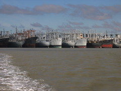
I grew up riding to the bay area in the family car at least twice a year. I was raised in Shasta County, up north, but Mom's best friend lives in San Leandro (about two miles from where we live now, she still lives in the same house she's lived in since the fifties) and my aunt lived in Palo Alto, so we'd come down for a couple of weeks every summer, and sometimes for Christmas or another break. Until the early seventies, we had no air conditioning, and in the summer, at least half the ride down is in temperatures over 90 or 100F, so Mom would load the car at night, toss the luggage (around the edges) and some pillows and blankets into the back of the station wagon, and toss me and my sister back there for the ride. I guess we'd leave the house around 3 or 4 in the morning, because my sister and I would wake up at sunrise, usually just in time for what Mom called "the mothball fleet." For me, that and the C&H sugar factory in Crockett were "now entering The Bay Area." Mom told us that the Navy always intended to re-use those ships, and that they were parked where they were because they had easy access to the ocean, but that the water in Suisun Bay wasn't as salty as that farther down into San Francisco Bay. I just loved them. For awhile, the Glomar Explorer was parked with them, that was exciting.

It never occurred to me until a few years ago that the ships were sitting there polluting the bay, though I knew that most of them couldn't possibly be reused now, fifty years after they were first moored. They're falling apart. To make them suitable for scrapping will mean doing things to them that will cause further water pollution. Are we just screwed?

Tuesday, October 23, 2007

Southern California is burning


Link list for mapping the southern California fires.

The LA Times and the OC Register are both using Google maps, natch.

Among the thoughts that keep cropping up in disorganized ways, for me:

1) It's scary and nauseating, how sociopathic arson is: "The fire broke out just as the Santa Ana winds were picking up. At one point, it flashed through three miles of parched-dry brush in less than 30 minutes.
"Whoever did this knew what they were doing," said Kris Concepcion, a battalion chief with the Orange County Fire Authority.


2) People continue to build homes in fire-prone (in California, it's fire-adapted, the ecology is healthier for regular, moderate fires) areas, and losing them.

3) If folks who are predicting the specific changes related to climate change are correct, wildfire seasons like this will get worse rather than better over the next century.

Wednesday, September 26, 2007

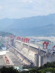
Three Gorges Dam pisses me off


Three Gorges Dam @ Sandouping
Originally uploaded by e_hoogie.
I used some pretty colorful language when I first heard about this:

In unusually frank language, Chinese officials publicly acknowledged "hidden dangers" at the massive Three Gorges Dam, including landslides, erosion and pollution that could lead to an environmental disaster if not quickly fixed.
"If no preventive measures are taken, the project could lead to catastrophe," the official Xinhua news agency said on its English-language newswire, paraphrasing experts speaking at a conference this week. As an indication of the government's sensitivity to the issue, that phrase wasn't included in all versions published by Xinhua.


and

It was hailed as one of the engineering feats of the 20th century. Now the Three Gorges Dam across China’s mighty Yangtze River threatens to become an environmental catastrophe.


and

"We cannot lower our guard against ecological and environmental problems caused by the Three Gorges project," Wang Xiaofeng, director in charge of building the dam, was quoted as saying. "We cannot win by achieving economic prosperity atthe cost of the environment."


Geological instability isn't the only unforeseen negative effect of the Three Gorges. Downstream of the dam, locals have been battling two billion rats forced into farmland by rising water levels after the dam authority released a large amount of Yangtze River water "to control flooding in the face of the annual rainy season".

Two billion rats.

People have been crying about this for years. A friend of mine in the early nineties, while in her mid-sixties, took a boat tour down the gorge because she thought she'd never have another chance to see it if she didn't go now. People have said we'd lose the river dolphin, for years. People have warned against pollutant build-up in the water, where folks get water for cooking, and bathe their babies. They worried about whether silt would fill the basin too fast, given how muddy the Yangtze is, or that the silt and other materials carried downstream would damage the turbines. They rallied against corrupt officials mishandling the funds used to relocate people, and of people whose rich farmland on which their families had worked for hundreds of years would be flooded, while they were given rocky hillsides as compensation. They raised a fuss about the drowning of barely visited or newly discovered archeological sites, of the loss of historic temples, of the effect on the people below if something happened to breach the dam. But there wasn't anything anyone could do to stop this dam.

Now that the damage has largely been done, they admit that there could be problems.

I just want to kick somebody.

Sunday, August 26, 2007

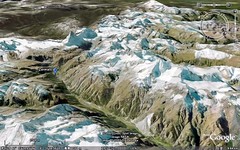
Google Earth Science

This is just pure smut, for the likes of me:

Designing and Creating Earth Science Lessons with Google EarthTM

It's like . . . . oooh. I'll be in my bunk.


I'd love to sit with a patient child or adult, with Google Earth, and talk about what it illustrates. It reminds me of lying on the floor over the atlases, when I was little.

Sunday, August 12, 2007

The Perseids


Lucky shot!
Originally uploaded by ♥♥ Jo ♥♥.
When I was a little girl, August was a scorcher where I lived, and we had a tiny, hot house. When it became too hot to sleep indoors, we'd spend a few nights outside on the lawn, in sleeping bags, and Mom would show us the constellations and tell us their stories. And right smack in the middle of August, we'd watch shooting stars. Shooting stars are always best in August, Mom told us. We'd stare and stare at the sky until we fell asleep, then wake at dawn.

They have a name now -- Perseids.
They have a scientific explanation. Mom told us they were rocks that flew through space and heated up when they went through our air, and that they almost never hit the earth because they burned up and were gone before they hit the ground. That's all we knew, and that was all that mattered, when I was six or so and sleeping on the lawn.

Sunday, August 05, 2007

quickie - SF after the big quake

Strangemaps shows San Francisco immediately post '06 quake. I love comparing old geography to modern geography, to see how humans have changed things. Look how China Basin once had so much water, and is now mostly filled in.

The epicenter (long thought to be at Olema, at the neck of Point Reyes) was actually a bit left of where the P in "Pacific Ocean" is, on this map, just offshore where the San Andreas goes into the sea near the Daly City/SF line.

Earthquakes simultaneously fascinate and terrify me. I can read just so much about them, and then I have to stop. Seismology is one of my favorite hobby fields, but I don't think I could study it as a focus in geology without becoming a gibbering mass of anxiety.

Sunday, July 29, 2007

An Island Called California


Yellow-billed Magpie
Originally uploaded by amkhosla.
"It is known that to the right of the Indies there exists an island called California very near the terrestrial paradise; and peopled by black women among whom there was not a single man since they lived in the way of the Amazons.

They had beautiful robust bodies, spirited courage and great strength. Their island was the most impregnable in the world with its cliffs and headlands and rocky coasts. Their weapons were all of gold . . . because in all the island there was no metal except gold.

And there ruled over that island of California a queen of majestic proportions, more beautiful than all others, and in the very vigor of her womanhood. She was not petite, nor blond, nor golden-haired. She was large, and black as the ace of clubs. But the prejudice of color did not then exist even among the most brazen-faced or the most copper-headed. For, as you shall learn, she was reputed the most beautiful of women; and it was she, O Californias! who accomplished great deeds, she was valiant and courageous and ardent with a brave heart, and had ambitions to execute nobler actions than had been performed by any other ruler — Queen Califia." -- from
Las sergas de Esplandián by Garci Rodríguez de Montalvo


Yesterday, StrangeMaps showed us a 15th Century map from China that shows what could even be Australia and New Zealand, as well as the classic Island of California off the west coast of North America. This map was created long before Columbus, Magellan, or Drake sailed the seas. Look how similar the continental boundaries are to today's maps, how well the coasts match what we now know.


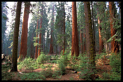
Though California isn't an island (it's probable that the opening to the Gulf of California and perhaps the Columbia River made it seem so), Elna Bakker used the idea for her book, Island Called California, about California's unique "island ecology." Because we have an ocean to our west, a high mountain ranges to the north and east (with those on the east backed by desert), and desert to the south and southwest, much of California's land is ecologically like an island, with endemic organisms of all sorts. Our magpies have yellow bills, our sequoias are unique, we have lilies and salamanders like no others. To be honest, as much as part of me supports the division of California into two states, a bigger part of me wants not to break that poetic island, to distribute yellow-billed magpies between two states, or to either divide or simply give up the sequoias as "my own."


As California changes with the climate, some of the animals -- amphibians and more delicate herbaceous plants, especially -- will have no place to go. The same barriers that allowed them to develop in unique ways will largely prevent them from adapting by gradually shifting their ranges elsewhere. Around the world, humans have made barriers of their own, as well. Plants and animals can't adapt by moving through farm belts, urban areas, or across new desertified regions, either. We are banishing our wildlife to islands to make do with what they have.